The World’s Greatest Road Trips:
Get your motor running .…and get ready to explore the undeniably magical freedom that comes from hitting the open road. From the winding coastal highways of Big Sur to the rugged outback trails of Australia, the world’s roads invite you to chase horizons, explore remote landscapes, and uncover hidden gems tucked far from the beaten path.
Whether you’re craving a soul-searching solo journey across continents or a laid-back weekend drive packed with scenic stops and good company, we’ve curated what we believe to be the top 30 road trips on Earth. These epic drives offer not just breathtaking views and cultural richness, but moments that can shift your perspective and stay with you for a lifetime. So fuel up, roll the windows down, and get ready to embark on one of the world’s greatest road trips.
1.) Pan-American Highway: The Ultimate Overland Adventure
Overview: The Pan-American Highway is often referred to as the longest motorable road in the world—a legendary ribbon of asphalt, gravel, and jungle tracks that connects the top of North America to the bottom of South America. It stretches from Prudhoe Bay, Alaska, on the Arctic Ocean, all the way to Ushuaia, Argentina, near the tip of Tierra del Fuego. Spanning over 19,000 miles (30,000+ kilometers), it crosses through 14 countries and nearly every landscape imaginable: icy tundras, dense tropical rainforests, high-altitude deserts, and rugged coastlines. While officially it’s a “network” of routes rather than a single uninterrupted highway, the sense of continuity and the transformative experience it offers has made it one of the world’s greatest overland adventures.
Travelers can expect to encounter an extraordinary range of cultures, languages, climates, and road conditions. The route passes through the Americas’ most vibrant cities and most isolated outposts—from modern metropolises like Mexico City and Bogotá to remote mountain villages and windswept Patagonian plains. Whether you’re doing it for the cultural immersion, the landscapes, or the challenge of the road itself, the Pan-American Highway is not just a drive—it’s a transcontinental pilgrimage. It’s one of the few ways to see the full geographical and cultural diversity of the Western Hemisphere from the ground up.
Distance: The total distance of the Pan-American Highway is approximately 30,000 km (19,000 miles) depending on the route taken and detours along the way.
Route: The traditional route begins in Prudhoe Bay, Alaska, and follows the Alaska Highway down through Canada and the western United States, often along the Pacific Coast Highway or I‑5 corridor. From there, it winds through Mexico, then Central America via Guatemala, El Salvador, Honduras, Nicaragua, Costa Rica, and Panama. At the Darien Gap, a 100-mile stretch of impassable jungle between Panama and Colombia, travelers must ship their vehicles by sea or air before continuing into South America.
Once in Colombia, the route typically runs south through Ecuador, the highlands of Peru, and the altiplano of Bolivia, before crossing into Chile and Argentina, eventually ending at Ushuaia, the southernmost city in the world. The beauty of this road trip lies in its flexibility: there are no hard rules, and every journey along the Pan-Am becomes its own unique story.
Estimated Time to Complete: On average, most travelers take 6 to 12 months to complete the full journey, though some overlanders stretch it over multiple years, while others race through in 3 to 4 months. It entirely depends on pace, border logistics, and travel style.
Things to See on the Way: Driving the Pan-American Highway offers access to some of the most iconic sights in the world. In Alaska, Denali National Park offers views of North America’s tallest peak and pristine wilderness. Banff and Jasper National Parks in Canada serve up turquoise lakes and mountain scenery that rival the Alps. Teotihuacan in Mexico is an ancient Aztec city with enormous pyramids just outside Mexico City. Lake Atitlán in Guatemala is a volcanic lake surrounded by traditional Mayan villages and crater walls. Cartagena in Colombia is a colorful colonial city on the Caribbean with vibrant culture and cobbled streets.
Continuing south, Machu Picchu in Peru is a must-see, perched high in the Andes and steeped in Incan history. Salar de Uyuni, Bolivia’s mirror-like salt flats, create surreal reflections and photo ops. The Atacama Desert in Chile is the driest desert in the world, perfect for stargazing and volcanic adventures. Finally, Patagonia and Tierra del Fuego offer glaciers, mountains, and a windswept end-of-the-world feeling that brings the journey to a dramatic conclusion.
Budget: Costs vary wildly depending on travel style, vehicle type, fuel prices, and time spent in each country. On a modest overlanding budget, many travelers report spending between $15,000 to $30,000 USD per vehicle for the full journey over 6–12 months. Fuel costs can range from very cheap (Venezuela, Bolivia) to high (USA, Chile). Shipping across the Darien Gap can cost between $1,000–$2,000 USD for a motorcycle and $2,500–$4,000 USD for a car or van, including flights for passengers. Camping, cooking your own food, and slow travel will dramatically lower your daily costs.
Difficulty: The Pan-American Highway is not technically difficult in many places—but it’s long, unpredictable, and can be logistically complex. Challenges include remote driving conditions in areas like the Bolivian highlands or Peruvian Andes, navigating bureaucracy at multiple borders, mechanical failures in rural zones, and the daunting shipping process at the Darien Gap. Weather can be extreme: snow in Alaska, torrential rains in Central America, and fierce winds in Patagonia. Political instability, corruption, and theft can be concerns in some areas, though many travelers report positive experiences with proper preparation and caution.
Need to Know: No single visa covers the entire route—you’ll need to research visa and vehicle import requirements for each country. For most of Central and South America, a Temporary Vehicle Import Permit (TIP) is issued at the border. Many travelers use carnet-free vehicles and simply deal with paperwork as they go. The Darien Gap is a major interruption in the route—there is no road, and travelers must arrange to ship their vehicles via container or use roll-on/roll-off ferries (when available). Spanish proficiency is extremely helpful in Latin America. Also, having international vehicle insurance (or buying it at the borders) is essential. Border crossings can be long and frustrating but manageable with patience and preparation.
Recommended Vehicle: Most overlanders choose either 4x4 trucks, vans, or adventure motorcycles. Popular choices include Toyota Land Cruisers, Sprinter vans, Ford Rangers, Mitsubishi Delicas, and dual-sport bikes like the Suzuki DR650 or BMW GS models. A well-maintained, high-clearance vehicle with good spare parts availability and a comfortable interior is ideal. That said, many travelers have completed the route in compact sedans, bicycles, and even school buses—what matters more is preparedness and resilience than the specific ride.
Top Photo Spot: Salar de Uyuni in Bolivia is one of the most photogenic stops on the entire route. The massive salt flats create mirror-like reflections during the rainy season and stretch endlessly during the dry season, making for stunning panoramic photos of your vehicle seemingly floating in the sky.
2.) Dakar Rally (Saudi Arabia Route)

Overview: The Dakar Rally is motorsport’s toughest off-road marathon: roughly two weeks of flat-out racing across Saudi Arabia’s mountains, canyons and the vast Empty Quarter desert. Every January, cars, bikes, quads, trucks and SSVs blast through 12 timed stages plus a prologue, covering nearly 8 000 km in total, more than 4 500 km of which are “specials” against the clock. Competitors tackle stony plateaus that shred tyres, dunes the height of office blocks, and 48-hour chrono or marathon stages in which they must service their own machines overnight.
While today’s rally centres on Saudi Arabia, the event was born in 1979 as the Paris-Dakar; security concerns pushed it to South America in 2009 and, since 2020, to the Arabian Peninsula. The spirit, however, is unchanged: a navigation-heavy endurance test where finishing is victory. Spectators can shadow liaison sections or camp near bivouacs for a front-row seat to the planet’s greatest desert race.
Distance Total: The modern Dakar Rally covers approximately 7,500 to 8,000 kilometers in total, depending on the year’s route design. Of this, between 4,500 and 5,200 kilometers are timed special stages.
Estimated Time to Complete: 14–15 days (12 racing stages + prologue and one rest/transfer day)
Route: The course typically begins in the southwest of Saudi Arabia, often in cities like Bisha or AlUla, and loops through a combination of rocky highlands, desert valleys, and massive dune fields before concluding on the Red Sea coast. The early stages may climb into the rocky canyons around Al Henakiyah, before pushing north toward the majestic rock formations of AlUla. After a rest day in the rally city of Ha’il, the route dives into the Rub’ al Khali—the Empty Quarter. This is where the rally reaches its crescendo: deep sand dunes, minimal landmarks, and extreme isolation dominate the final stages. The finish varies by edition, but often takes place near the Red Sea, in cities like Yanbu or Shubaytah. Each year’s route is different, with daily surprises that test both speed and navigation. Cars and bikes often tackle split tracks on specific days for safety and variation.
Routes are redesigned annually, but always include a mix of fast gravel, technical canyons, and monster dune seas. Motorcycles and cars often get split courses on selected days to improve safety and navigation.
Things to See on the Way: Along the rally route, there are spectacular natural and cultural landmarks. AlUla is a visual marvel with its sandstone spires and ancient tombs of Hegra, a UNESCO World Heritage site. The Empty Quarter, or Rub’ al Khali, is the world’s largest uninterrupted sand desert—waves of towering dunes stretching to the horizon. Ha’il offers a blend of modern rally infrastructure and historic caravan culture, known for its ancient petroglyphs and welcoming Bedouin traditions. The Jabal Al-Qahar escarpment features stark volcanic cliffs and surreal panoramic views over black lava fields. The Red Sea coast near Yanbu, often the ceremonial finish, brings a dramatic contrast of turquoise waters and coral reefs meeting desert cliffs.
Budget: Participating in the Dakar Rally is a major financial undertaking. Competitor costs range from $100,000 to over $500,000 depending on the vehicle class, logistics, and team setup. These costs include the entry fee, rally vehicle prep, spares, and support crew. For adventurous followers and fans who want to track the rally from the ground, budget-friendly options still hover between $5,000 and $12,000 for two weeks. This includes renting a 4×4, fuel, bivouac access passes, food, and camping or budget hotels.
Difficulty: The Dakar is widely considered the most difficult rally on Earth. Special stages can stretch over 800 kilometers in a single day, with long transfer sections in between. Extreme temperatures, treacherous terrain, mechanical failures, and navigational errors are daily threats. Attrition rates are high—often only about 60 percent of the field reaches the finish line. Physical stamina, mechanical skill, and mental toughness are as critical as driving or riding talent.
Need to Know: To join or follow the Dakar Rally, preparation is key. International entrants require a Saudi visa and a Carnet de Passage for vehicle customs. Competitors must navigate using GPS-based roadbooks; external digital maps or navigation aids are banned. Fuel stops are sparse—vehicles must have a minimum fuel range of 250 kilometers. On marathon stages, participants are fully self-reliant, with no outside assistance allowed overnight. Spectators should always stay far from active tracks and dunes, as fast-approaching vehicles can be difficult to hear or see in time.
Recommended Vehicle: In the car category, elite teams drive modified machines like the Toyota GR Hilux T1+, Prodrive Hunter, or Mini JCW Rally Plus. For bikes, leading riders use KTM 450 Rally, Honda CRF450 Rally, or Husqvarna FR450 platforms, all purpose-built for Dakar. Truck teams favor rugged powerhouses like the Kamaz Master K5 or Iveco Powerstar. Regardless of class, every vehicle is a specialized off-road beast engineered to survive the most demanding race in the world.
Top Photo Spot: The Empty Quarter offers the most iconic photo opportunity: golden dunes rippling into the distance with solitary riders or vehicles catching air as they crest the ridge. The golden hour light in this remote expanse produces some of the most stunning imagery in all of motorsport.
3.) Mongol Rally (UK to Mongolia)
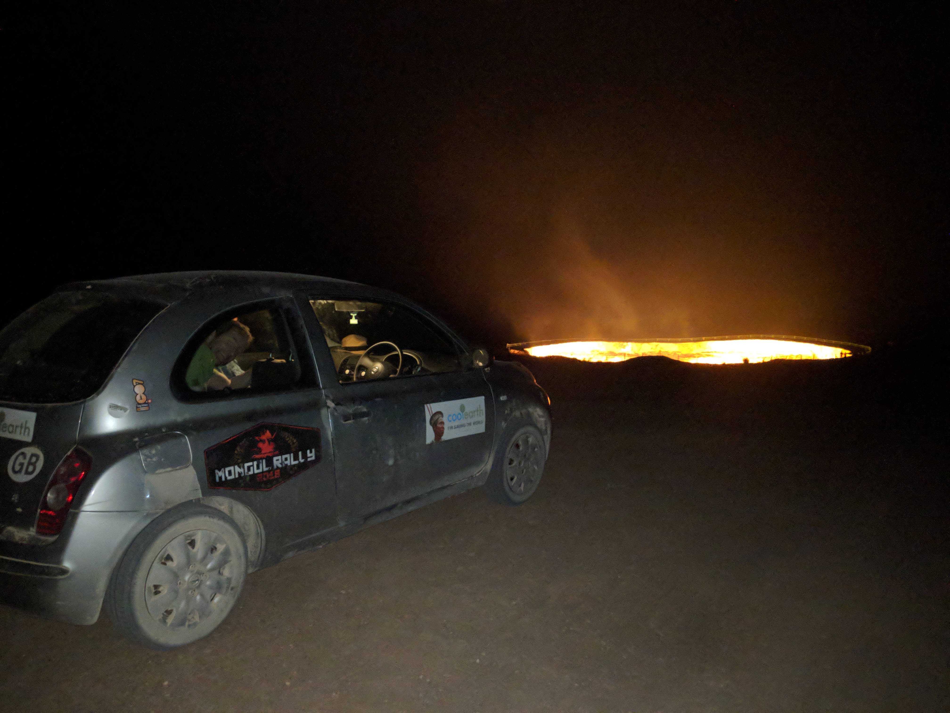
Overview: The Mongol Rally is not your average road trip—it’s a no-rules, no-support, transcontinental adventure that pushes you and your tiny car through some of the most remote and rugged parts of the world. Organized loosely by The Adventurists, the rally starts in southern England, typically at a launch party in Goodwood or Prague, and ends thousands of miles away in Ulaanbaatar, Mongolia or further east, depending on the year. What makes it legendary is that there’s no set route, no official support crew, and participants are strongly encouraged to use wholly inappropriate vehicles under 1.2 liters in engine size. In essence, it’s chaos by design—and that’s exactly the point.
Spanning over 15,000 kilometers and typically crossing 15 to 20 countries, the rally tests both your wits and your wheels. You’ll drive through a mosaic of terrain, from the tidy roads of Western Europe to the mountain passes of the Caucasus, the barren deserts of Central Asia, and the windswept steppe of Mongolia. The Mongol Rally is equal parts suffering and soul-stirring freedom. It’s less about racing and more about storytelling—flat tires in the Kazakh steppe, border delays in Uzbekistan, and vodka-fueled hospitality from strangers. There’s a reason it’s become a rite of passage for travelers with a taste for adventure and a tolerance for unpredictability.
Total Distance: Depending on the route you take, the rally typically covers between 13,000 and 16,000 kilometers from Europe to Mongolia or beyond.
Route: There is no official route, but most participants follow a general arc: leaving the UK and traveling through Western and Eastern Europe, then choosing a southern route via Turkey and Iran (when politically open), or a northern route through Russia and the Caucasus. Many veer into Central Asia via the famed Pamir Highway through Tajikistan or head north through Kazakhstan before entering Mongolia. The classic finish line used to be in Ulaanbaatar, though in recent years, it has extended east or shifted to different locations in Siberia or Mongolia. The path is entirely up to you, with endless possibilities—and plenty of wrong turns along the way.
Participants choose their own path, facing challenges like border crossings, visa requirements, and varying road conditions. The lack of a fixed route adds to the rally’s unpredictability and allure.
Estimated Time to Complete: Most teams complete the journey in 4 to 8 weeks, though some speed through in less than a month while others take several months to explore along the way.
Things to See on the Way: Driving the Mongol Rally offers a changing canvas of cultures and landscapes. In Turkey, Cappadocia is a surreal region of cave dwellings and hot air balloons rising over rock chimneys. Georgia’s Kazbegi region offers dramatic mountain views and medieval hilltop churches. The Pamir Highway in Tajikistan is one of the world’s most remote and breathtaking mountain roads, with high passes and vast valleys. Uzbekistan’s Silk Road cities—Samarkand and Bukhara—are lined with Islamic architecture and buzzing bazaars. Kazakhstan surprises with its vast emptiness and cities like Almaty offering a mix of Soviet legacy and modern cafes. And in Mongolia, the Gobi Desert and Orkhon Valley deliver unmatched wilderness, yurt stays, and endless skies.
Budget: The Mongol Rally is not cheap, but it can be done relatively affordably depending on your choices. The entry fee is usually between $700 and $1,000 USD, not including the charity donation (a core part of the rally ethos). On top of that, budget for $5,000 to $10,000 per team for the trip itself, depending on your pace and breakdowns. Shipping the vehicle back from Mongolia or onward to your next destination can cost an additional $1,500–$3,000, unless you sell or abandon it (often with pre-arranged paperwork). Expect fluctuating fuel costs, visa fees for 8–12 countries, and potential bribes or border crossing costs in some regions.
Difficulty: While it’s not technically difficult in a traditional racing sense, the rally presents major logistical and mechanical challenges. Cars break down. Roads vanish. Border crossings can be slow and confusing. Maps may be outdated or nonexistent. You’ll often be far from help, especially in Mongolia and Central Asia, and may need to perform roadside repairs with basic tools and little support. The rally favors ingenuity over experience—navigating by intuition, repairing on the fly, and finding creative solutions when stranded in the middle of nowhere.
Need to Know: Visas are one of the most time-consuming parts of planning. Countries like Russia, Iran, Turkmenistan, and several Central Asian states require advance applications, with some requiring letters of invitation and precise travel dates. You’ll also need international vehicle insurance (or buy border-specific coverage), registration documents, and the all-important Carnet de Passage for certain routes. Communication in remote areas can be difficult—bring offline maps and possibly a satellite phone. Teams often connect via WhatsApp or other apps to share real-time tips and help. Breakdown prep is key: pack spare parts, know how to change tires, and be ready for creative problem-solving.
Recommended Vehicle: In true Mongol Rally fashion, you’re supposed to use an old, underpowered, questionably reliable car—ideally with an engine size under 1.2 liters. The less suited it is for the terrain, the more fun (and breakdowns) you’ll have. Common vehicles include Nissan Micras, Fiat Pandas, old Renaults, or Suzuki Altos. Some teams opt for scooters, ambulances, or fire trucks just to up the ridiculousness. What matters most is that it’s fixable with duct tape and string, and that it has character.
Top Photo Spot: One of the most iconic rally shots is at the Flaming Cliffs in Mongolia’s Gobi Desert—red sandstone cliffs glowing at sunset with your dusty car parked on the edge, surrounded by nothing but silence and steppe. Another must-shoot moment is your vehicle arriving under the giant “Welcome to Mongolia” arch after the grueling Kazakh border crossing, signaling that the final challenge has begun.
4.) Rickshaw Run (India)

Overview: The Rickshaw Run is one of the most chaotic, hilarious, and unpredictable road adventures on the planet. Organized by The Adventurists, this event challenges participants to drive a 7‑horsepower auto-rickshaw—yes, the same three-wheeled vehicle used for short commutes—across the length or breadth of India. With no set route, no support, and very few rules, it’s a true trial by fire designed to immerse you in the sheer madness of Indian roads, culture, and landscape. Whether you’re weaving through Himalayan switchbacks or dodging cows in congested city traffic, the Rickshaw Run is a sensory overload from start to finish.
Each edition of the rally changes in terms of start and end points, but it typically covers 3,000 to 4,000 kilometers between locations like Kochi, Jaisalmer, Shillong, or Goa. The journey spans deserts, jungles, coasts, and mountains—and throws you headfirst into the vibrant, chaotic beauty of India. You’ll sleep in tiny villages, get lost often, and form deep bonds with locals (often while pushing your broken-down rickshaw). The Rickshaw Run isn’t about speed—it’s about the stories, the mishaps, and the deep immersion into one of the most intense and rewarding travel experiences you can find.
Distance: Between 3,000 to 4,000 kilometers, depending on the specific start and finish cities of the edition you choose.
Route: There’s no fixed route. Teams choose their own paths between the designated start and end points, which change with each event. A classic example is Kochi in the south to Jaisalmer in the desert northwest, or Shillong in the northeast to Kochi. Routes take you through some of India’s most contrasting terrain: the Thar Desert, Western Ghats, Himalayan foothills, rice paddies, tropical coastlines, and megacities like Delhi and Mumbai. The only rule is to get from A to B in your rickshaw—however you manage it.
Estimated Time to Complete: Most participants take 2 to 3 weeks to complete the journey, with some pushing through in 10 days and others stretching it to nearly a month.
Things to See on the Way: On a southern route, you might pass through Hampi, an ancient city of temples and surreal boulder-strewn landscapes. The Western Ghats offer lush jungle drives with waterfalls and tea plantations. If crossing Rajasthan, stop at Jodhpur’s Blue City and the golden fort of Jaisalmer. Northern routes might take you past Varanasi, the spiritual heart of India on the Ganges River. In the northeast, you’ll find the Khasi Hills and living root bridges of Meghalaya. The Taj Mahal in Agra, the beaches of Goa, or the Himalayan views from Sikkim could all be part of your spontaneous itinerary.
Budget: Entry fees start around $2,000–$2,500 USD per team (including the rental rickshaw, entry, and basic rally support like paperwork and briefing). Beyond that, plan to spend between $2,000 and $4,000 on accommodation, fuel, food, and unexpected repairs. Fuel is cheap, but frequent repairs and spontaneous detours can add up. Most nights you’ll stay in budget guesthouses or sleep wherever you break down. Meals range from $1 street snacks to $10 sit-down meals. This is a backpacker’s road trip—no frills, lots of fun.
Difficulty: Driving a tuk-tuk across India is not easy. These vehicles break down often, are slow (maxing out at 55 km/h downhill), and are mechanically basic, meaning you’ll probably learn how to repair a clutch cable on the roadside. Roads vary from smooth highways to dirt tracks with potholes the size of your front wheel. Indian traffic is unpredictable and overwhelming at first, but locals are generally helpful and understanding when they see confused foreigners in a painted rickshaw. Mental resilience and flexibility are more important than driving skill.
Need to Know: No prior rickshaw experience is needed—there’s a day of basic training at the launch site. You’ll need an international driving permit, a sense of humor, and strong travel insurance (required by the organizers). The Adventurists provide the vehicle, mechanical training, and logistical guidance, but not a route or backup plan. Indian SIM cards, offline maps, and a toolkit are essential. You’ll be off the tourist path often, so basic Hindi phrases can help. Prepare for culture shock, weather extremes, and some of the most spontaneous hospitality you’ll ever receive.
Recommended Vehicle: You don’t have a choice: it’s a 7‑horsepower Bajaj auto-rickshaw. But you can paint it however you want, decorate it with flags, add your mascot, or make it into a moving art piece. It’s tiny, underpowered, and incredibly unreliable—which is what makes the whole journey so memorable.
Top Photo Spot: One of the most iconic Rickshaw Run photos is your tuk-tuk silhouetted against the setting sun in the Thar Desert near Jaisalmer. Another favorite is winding through the lush tea plantations of Kerala or crossing rickety Himalayan bridges, where your brightly colored rickshaw stands out against epic backdrops. If you survive it, a photo at the finish line—rickshaw battered, dusty, and fully stickered—is the ultimate trophy.
5.) Route 66 (USA)

Overview: Few road trips are as iconic—or as deeply embedded in American cultural mythology—as Route 66. Known as the “Mother Road,” this legendary highway stretches from Chicago, Illinois to Santa Monica, California, covering over 2,400 miles of diverse terrain and roadside Americana. Once the main artery for Americans heading west during the Dust Bowl and later a symbol of post-war mobility and freedom, Route 66 represents more than just a road—it’s a piece of history that rolls through ghost towns, neon-lit diners, classic motels, and vintage gas stations.
Though officially decommissioned in 1985, Route 66 remains drivable thanks to preservation efforts and signage marking the “Historic Route.” What makes this journey truly special is the sense of nostalgia, discovery, and community that comes from cruising through small-town America. Each stretch of the road offers glimpses into a bygone era—old-fashioned soda fountains, hand-painted signs, drive-ins, and museums celebrating its quirky legacy. It’s not about getting from point A to point B; it’s about the experience of the open road and the unexpected gems along the way.
Distance:Approximately 3,940 kilometers (2,448 miles) from Chicago, Illinois to Santa Monica, California.
Route: Route 66 begins in downtown Chicago and winds through eight states—Illinois, Missouri, Kansas, Oklahoma, Texas, New Mexico, Arizona, and California—before ending at the Pacific Ocean in Santa Monica. Along the way, the route passes through major cities like St. Louis, Tulsa, Oklahoma City, Albuquerque, and Los Angeles, while also weaving through rural towns and scenic byways. Though parts of the original road are no longer drivable, alternate alignments and preserved stretches ensure you can still follow nearly the entire path.
Estimated Time to Complete: Most travelers take between 2 to 3 weeks to drive the full route, though it can be done in as little as 10 days or stretched out over a month or more depending on detours and sightseeing.
Things to See on the Way: In Illinois, stop at the Route 66 Hall of Fame and Museum in Pontiac. In Missouri, marvel at the Gateway Arch in St. Louis. Kansas offers a brief but charming stretch with old gas stations in Galena. In Oklahoma, the Blue Whale of Catoosa is a whimsical roadside relic. Texas brings you to Cadillac Ranch, where half-buried cars are spray-painted by visitors. In New Mexico, explore Albuquerque’s historic Old Town and the neon-lit streets of Tucumcari. Arizona features the Petrified Forest National Park and the quirky town of Seligman. And in California, visit the Wigwam Motel in San Bernardino before ending at the Santa Monica Pier.
Budget: Costs will vary based on duration, vehicle choice, and accommodation style. A typical two-week trip with a rental car, motels, and meals can range from $2,000 to $4,000 USD. Gasoline will be one of your main expenses, especially with detours. Budget travelers can camp or choose budget motels, while higher-end travelers may stay in boutique retro inns. Attractions are generally affordable or free, though some museums and guided tours may charge small fees.
Difficulty: Route 66 is one of the easiest major road trips in terms of infrastructure and driving conditions. Roads are well-maintained and signage is good in most areas, though having a Route 66-specific guidebook or GPS app helps. Challenges may come from navigating detours where original segments no longer exist. The heat in the Southwest can be intense in summer, so plan accordingly and keep your vehicle in good shape.
Need to Know: While parts of Route 66 are integrated into the modern Interstate system, you’ll need to follow “Historic Route 66” signs or use GPS/guidebooks to stick to the old path. Spring and fall are the best seasons to avoid the extreme summer heat and winter snow in the Midwest. Book classic motels in advance, especially during peak travel months. Many businesses thrive on Route 66 tourism, so take time to support local diners, shops, and quirky roadside stops. And don’t rush—it’s a journey, not a race.
Recommended Vehicle: Any roadworthy car will do for this trip, though something with comfort and space is ideal for the long stretches. Many opt for convertibles, vintage cars, or rental RVs to fully embrace the Americana vibe. Fuel efficiency and good AC are important in the Southwest. Motorcycle road trippers also find Route 66 a favorite ride, especially during early summer or fall.
Top Photo Spot: The end of the road: the Santa Monica Pier, where Route 66 officially terminates, is the most iconic photo stop. Other must-capture moments include the Cadillac Ranch in Texas, the neon signs of Tucumcari in New Mexico, and the historic gas stations and motels along the way—especially the Blue Swallow Motel in New Mexico or the Gemini Giant in Illinois.
6.) USA Coast-to-Coast (NYC to LA or similar)
Overview: The USA Coast-to-Coast road trip is the very definition of the great American adventure. It is a journey that captures the vast scale and diversity of the country, as you drive from one ocean to the other. Starting in the cultural and architectural wonderland of New York City and ending under the palm trees of Los Angeles, the route crosses rolling farmlands, soaring mountain ranges, expansive deserts, quirky roadside towns, and some of the most iconic cities and national parks on Earth.
You’ll encounter the full spectrum of the American experience along the way — from the steel-and-glass skylines of the Northeast, through the heartland’s small towns and prairies, past storied highways like Route 66, and into the cinematic landscapes of the Southwest. This is more than a road trip; it’s a cross-sectional journey through American history, culture, and natural beauty. Whether you follow a classic route or create your own detours, each leg of the trip offers unforgettable experiences. Expect surprises, iconic photo ops, and plenty of moments where the open road stretches to the horizon.
Distance: The typical coast-to-coast route covers approximately 4,500 to 5,000 kilometers (about 2,800 to 3,100 miles), though this can vary based on the specific path you choose and how many detours you take for sightseeing.
Route: One of the most popular and historically rich routes is a variation of the old Route 66, taking you through Chicago, St. Louis, Oklahoma City, Albuquerque, and on toward California. Many modern travelers opt for a more flexible combination of I‑80, I‑70, I‑40, or I‑10, depending on the season and points of interest. A sample route might begin in New York City, head through Philadelphia and Pittsburgh, swing west to Chicago, then south through St. Louis and Oklahoma, across the vast open landscapes of Texas and New Mexico, through the red rocks of Arizona, and finish in the City of Angels. Whichever route you choose, the magic lies in the mix of legendary highways and off-the-beaten-path discoveries.
Estimated Time to Complete: To truly experience a coast-to-coast journey without rushing, a time frame of two to four weeks is recommended. Two weeks is the bare minimum if you want to see the highlights along the way without constant long driving days. Three to four weeks allows for a more relaxed pace with overnight stays in memorable small towns, extra time in major cities, and the ability to take scenic detours through national parks and natural wonders. For those with more flexibility, taking five or six weeks to thoroughly explore the entire route can turn this into a once-in-a-lifetime adventure.
Things to See on the Way: A USA Coast-to-Coast road trip offers a seemingly endless array of things to see and do. Beginning in New York City, there is no shortage of world-famous landmarks to explore, from the Empire State Building to the Brooklyn Bridge. As you travel west, cities like Philadelphia and Chicago present rich cultural experiences, historic architecture, and vibrant food scenes.
Driving through the Midwest and the Great Plains, you’ll encounter quintessential Americana — roadside diners, vintage motels, and small towns that seem frozen in time. In the Southwest, natural wonders abound, including the Grand Canyon, Petrified Forest, and the surreal landscapes of the Mojave Desert. Arriving in California, the transition from desert to coast is dramatic and beautiful. The Santa Monica Pier, where Route 66 symbolically ends at the Pacific Ocean, provides a perfect photo opportunity to mark the completion of your journey.
Budget: The budget for a USA Coast-to-Coast road trip can vary widely depending on your style of travel. For a budget-conscious traveler, who might camp or stay in budget motels and prepare simple meals, expect to spend between $1,500 and $2,500 USD per person. A more typical mid-range experience, involving comfortable hotels, a mix of restaurant dining, and visits to major attractions, will likely fall in the range of $2,500 to $4,500 USD per person. For those seeking a more luxurious experience — staying in boutique hotels, dining at fine restaurants, and taking guided tours — costs can easily exceed $5,000 USD per person. Fuel, accommodation, and food will make up the bulk of your expenses, with additional costs for national park entry fees and special attractions.
Difficulty: Overall, the USA Coast-to-Coast road trip is of moderate difficulty. The roads themselves are well-maintained, and services such as gas stations, accommodations, and restaurants are widely available throughout most of the country. However, the sheer distance involved can make for long driving days, and you’ll need to pace yourself to avoid fatigue. Weather can also present challenges, particularly in winter when snow and ice can affect travel in northern regions or mountain passes. Driving through major cities such as New York, Chicago, and Los Angeles can involve heavy traffic and require extra patience. With some planning and flexibility, though, this road trip is accessible to most travelers and highly rewarding.
Need to Know: The USA is an excellent country for road trips, with infrastructure that supports travelers at nearly every turn. Gas stations, fast food outlets, and accommodations are easy to find, especially along the interstate highways. That said, distances between major stops can be long in certain regions, particularly in the Southwest, so plan your fuel and rest stops carefully. While interstates are the fastest way to cover ground, many of the most memorable moments happen on smaller highways and backroads.
It’s advisable to carry both cash and credit cards, as some rural establishments may not accept cards. Be aware of varying speed limits as you cross state lines, and always follow local driving regulations. In terms of timing, consider the season carefully — northern routes can be treacherous in winter, while desert regions can be oppressively hot in summer. A bit of research and preparation will go a long way in ensuring a smooth and enjoyable journey.
Recommended Vehicle: The ideal vehicle for a USA Coast-to-Coast road trip is one that combines comfort, reliability, and decent fuel efficiency. A midsize sedan, crossover, or SUV is perfect for most travelers, providing enough space for luggage and comfort on long driving days. For those wanting a more adventurous experience, an RV or camper van offers flexibility and the opportunity to camp along the route, though it may be less convenient for navigating busy city centers. Regardless of your choice, ensure your vehicle is in excellent condition before embarking on the trip, and consider carrying a spare tire, basic tools, and an emergency kit.
Top Photo Spot: One of the most iconic photo opportunities of the entire journey is at the Santa Monica Pier in Los Angeles, where the historic Route 66 sign marks the symbolic end of your cross-country adventure. Standing with the Pacific Ocean behind you, after having driven across an entire continent, makes for a perfect and unforgettable travel photo.
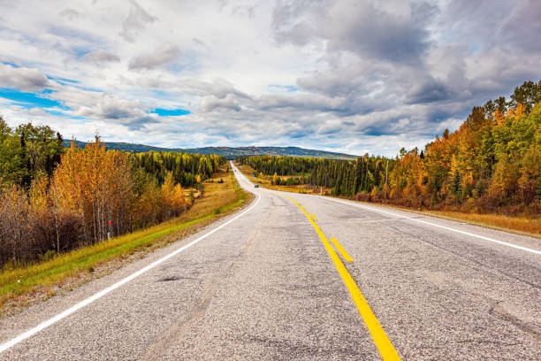
7.) Icefields Parkway (Canada, Alberta)

Overview: The Icefields Parkway, or Highway 93, is often described as one of the most beautiful road trips in the world — and for good reason. Stretching between Lake Louise and Jasper in Alberta, Canada, this 230-kilometer route slices through the heart of the Canadian Rockies, offering dramatic views at nearly every turn. Towering peaks, ancient glaciers, turquoise lakes, sweeping valleys, and cascading waterfalls form a landscape that feels both wild and timeless.
This is not a road trip where the goal is simply to reach your destination. The journey itself is the main event, and almost every kilometer invites you to stop, explore, and marvel. From iconic sites like Peyto Lake and Athabasca Glacier to hidden gems tucked away in alpine meadows, the Icefields Parkway offers an unparalleled connection to the raw beauty of nature. Whether you drive it in a single day or take several days to fully explore, this is a road that leaves a deep and lasting impression.
Distance: The Icefields Parkway is approximately 230 kilometers long, or about 143 miles. Though it is a relatively short drive in terms of distance, the abundance of sights along the way means that you’ll want to dedicate ample time to truly experience it.
Route: The route runs north-south between Lake Louise, located in Banff National Park, and the town of Jasper in Jasper National Park. Most travelers begin in Lake Louise and head north toward Jasper, though the drive is equally spectacular in either direction. Along the way, the road parallels the Continental Divide, climbing through mountain passes and skirting vast icefields. Key points of interest include Bow Lake, Peyto Lake, Mistaya Canyon, the Columbia Icefield and Athabasca Glacier, Sunwapta Falls, and Athabasca Falls. Numerous scenic pullouts and short hiking trails invite you to linger and explore beyond the roadside.
Estimated Time to Complete: While it is possible to drive the entire Icefields Parkway in three to four hours without stopping, doing so would miss the essence of the journey. A full day allows time for leisurely stops and short hikes at major viewpoints. For a more immersive experience, consider spreading the drive over two days, with an overnight stay near the Columbia Icefield or in Jasper, so you can take in sunrise and sunset in this remarkable landscape.
Things to See on the Way: The Icefields Parkway is densely packed with natural wonders. Lake Louise and Bow Lake provide perfect mirror reflections of surrounding peaks. Peyto Lake, with its famous wolf-head shape, is one of the most photographed locations in the Rockies. The Columbia Icefield and Athabasca Glacier offer the rare opportunity to walk on ancient ice or take a guided tour onto the glacier itself. Waterfalls such as Sunwapta Falls and Athabasca Falls deliver dramatic displays of power, especially during the spring melt. Wildlife sightings are common throughout the drive — you may encounter black bears, grizzly bears, elk, bighorn sheep, mountain goats, and more. Every stop along the Parkway offers its own version of alpine magic, whether it’s a serene lake, a roaring waterfall, or a breathtaking overlook.
Budget: The cost of driving the Icefields Parkway can be quite manageable, especially for those based in or traveling through Alberta. A Canadian Parks Discovery Pass is required for access to Banff and Jasper National Parks; this can be purchased as a daily pass or as an annual pass for greater flexibility. Fuel, food, and accommodation will be the primary expenses. Budget travelers can camp at one of the many scenic campgrounds along the Parkway, while mid-range travelers often stay in lodges or hotels in Jasper or Lake Louise. Tours of the Athabasca Glacier or guided hikes will add to your costs if you choose to include them.
Difficulty: The Icefields Parkway is an easy drive in good weather, with well-maintained roads and ample signage. However, conditions can change quickly in the mountains, particularly in early spring or late fall, when snow and ice may still be present. Travelers should check road conditions before setting out and ensure their vehicle is suitable for mountain driving. Cell service is limited along much of the Parkway, so it is wise to download offline maps and bring emergency supplies. In peak summer months, the road can be busy, especially at major viewpoints, but overall it remains an enjoyable and accessible route.
Need to Know: The Icefields Parkway is a protected corridor through two national parks, and visitors should respect wildlife and natural areas by keeping a safe distance and following Leave No Trace principles. Gas stations are very limited along the route — the last major fuel stop before Lake Louise is in the village of Lake Louise itself, and the next opportunity is at Saskatchewan River Crossing (seasonal) or Jasper. It is essential to fill your tank before beginning the drive. Bring plenty of food and water, as services are limited and expensive along the Parkway. Also, be prepared for changing weather; even in summer, temperatures can vary widely, and sudden storms are possible. Starting the drive early in the day helps avoid crowds at popular viewpoints and increases your chances of seeing wildlife.
Recommended Vehicle: Any standard vehicle can handle the Icefields Parkway under normal summer conditions. A comfortable car or SUV with good visibility will enhance your experience, allowing you to enjoy the views and stop easily at roadside pullouts. If traveling in spring or fall, consider a vehicle with all-wheel drive or winter tires, as snow and ice can linger at higher elevations. For those interested in camping, a camper van or RV can also be a good choice, though be mindful of parking limitations at some viewpoints.
Top Photo Spot: One of the most iconic photo spots along the Icefields Parkway is the viewpoint overlooking Peyto Lake. From a short uphill walk, visitors are rewarded with a panoramic view of this glacier-fed lake, whose brilliant turquoise waters and distinctive shape make for a truly unforgettable image. It perfectly captures the beauty and wonder of this incredible road trip.
8.) Iceland Route 1 / Ring Road

Overview: Iceland’s Ring Road, also known as Route 1, is one of the most spectacular and accessible road trips on the planet. Encircling the entire island, this journey takes you through a landscape shaped by fire and ice, where towering volcanoes rise above vast lava fields, glaciers tumble into lagoons, and waterfalls cascade from towering cliffs. The ever-changing scenery is both otherworldly and deeply captivating, making the Ring Road a true adventure through nature’s extremes.
Driving the Ring Road allows you to experience Iceland’s dramatic contrasts — black sand beaches, steaming geothermal areas, iceberg-filled lagoons, moss-covered lava plains, and charming fishing villages. Along the way, you’ll encounter both iconic landmarks and hidden corners, with opportunities for hiking, wildlife watching, and soaking in geothermal pools. Whether you’re chasing the midnight sun of summer or the northern lights of winter, this is a road trip where the journey itself is the destination.
Distance: The full Ring Road loop is approximately 1,320 kilometers, or about 820 miles. The exact distance will vary depending on detours and side trips, which are highly recommended to experience the best of Iceland’s natural wonders.
Route: The Ring Road forms a complete loop around the island, connecting the capital city of Reykjavik with the country’s remote eastern fjords, northern highlands, and dramatic southern coast. Most travelers begin and end their journey in Reykjavik, traveling either clockwise or counterclockwise around the island. The route passes through Iceland’s major regions, including the popular South Coast, the glacier-filled Vatnajökull National Park, the serene East Fjords, the geothermal wonders of Lake Mývatn, and the wild landscapes of North Iceland. Each section of the Ring Road offers its own distinct beauty and character. While the main route itself is paved and well-maintained, numerous gravel side roads lead to hidden waterfalls, secluded hot springs, and off-the-beaten-path hiking trails.
Estimated Time to Complete: While it is technically possible to drive the Ring Road in as little as four or five days, doing so would mean rushing past many of Iceland’s most breathtaking sites. A more comfortable and rewarding itinerary spans seven to ten days, allowing time for scenic detours, leisurely hikes, and immersion in local culture. Travelers with two weeks or more can truly explore the island in depth, venturing into remote peninsulas, taking boat tours in glacier lagoons, and visiting lesser-known geothermal areas. The flexibility of a self-drive tour makes it easy to tailor the experience to your interests and pace.
Things to See on the Way: The Ring Road offers an astonishing array of natural wonders. Along the South Coast, highlights include Seljalandsfoss and Skógafoss waterfalls, the black sands of Reynisfjara Beach, and the glacier lagoon of Jökulsárlón, where icebergs drift out to sea. Vatnajökull National Park features massive ice caps and shimmering glacial tongues. The East Fjords present a quieter, more rugged landscape, dotted with fishing villages and dramatic coastal cliffs.
In the north, Lake Mývatn is a geothermal hotspot with bubbling mud pots and volcanic craters, while nearby Dettifoss, Europe’s most powerful waterfall, roars through a canyon of black basalt. Akureyri, Iceland’s northern capital, offers urban comforts and whale-watching excursions. The western portion of the Ring Road brings travelers through lush valleys, volcanic fields, and scenic fjords, with optional detours to the Snæfellsnes Peninsula, often called “Iceland in Miniature” for its diverse landscapes. Throughout the journey, frequent encounters with Icelandic horses, puffins, seals, and even reindeer add to the magic of the road trip.
Budget: A Ring Road road trip can be adapted to a wide range of budgets. Budget travelers can camp or stay in guesthouses and self-cater meals, with typical costs ranging from $1,000 to $1,800 USD per person for a week-long trip. Mid-range travelers, staying in comfortable hotels or farm stays and dining out regularly, can expect to spend between $2,000 and $3,000 USD per person. Luxury travelers opting for boutique accommodations, private tours, and fine dining may spend $4,000 USD or more per person. The largest expenses typically include car rental, accommodation, and fuel, with optional guided tours and entry fees for specific attractions adding to the total cost.
Difficulty: Driving the Ring Road is generally straightforward and well-suited for most travelers. The main route is paved and well-maintained year-round, though winter conditions can make driving more challenging due to snow, ice, and limited daylight. Travelers should always check weather and road conditions before setting out, especially during shoulder seasons or winter. Many of the most spectacular sites are easily accessible from the main road, but gravel side roads require careful driving, and some highland roads (known as F‑roads) are only open in summer and require a 4x4 vehicle. With proper preparation and a flexible itinerary, the Ring Road is an unforgettable and highly manageable road trip.
Need to Know: A self-drive trip around the Ring Road offers tremendous freedom but also requires a bit of planning. Fuel stations are available along the route, but in remote areas, they can be far apart — it’s wise to refuel whenever possible. Similarly, accommodations in popular regions can book up months in advance, especially in summer, so early planning is recommended.
The weather in Iceland is famously unpredictable, with sudden shifts even in summer, so travelers should dress in layers and be prepared for wind and rain. In winter, it’s important to monitor road conditions and weather forecasts closely, as storms can make travel hazardous. Driving with caution, particularly on narrow or gravel sections, ensures a safe journey. Lastly, respecting nature is crucial; Iceland’s fragile ecosystems and dramatic landscapes require visitors to stay on marked paths, avoid off-road driving, and leave no trace.
Recommended Vehicle: In summer, a standard two-wheel-drive car is perfectly suitable for completing the Ring Road, as the entire main route is paved. However, for those planning to explore gravel side roads, visit more remote areas, or travel in shoulder seasons, a four-wheel-drive vehicle offers added safety and flexibility. In winter, a 4x4 vehicle with proper winter tires is highly recommended, as icy conditions and snow can appear without warning. Comfort is also an important consideration, as the distances between key attractions can involve long days of driving — choose a vehicle that will keep you relaxed and prepared for Iceland’s ever-changing roads.
Top Photo Spot: One of the most iconic photo opportunities along the Ring Road is the Jökulsárlón glacier lagoon, where luminous blue icebergs float serenely against a backdrop of towering glaciers and black sand beaches. Whether bathed in soft summer light or framed by the ethereal glow of the northern lights, this stunning location perfectly encapsulates the surreal beauty of Iceland’s landscapes and serves as an unforgettable highlight of the journey.
9.) The Alp Run (Switzerland & Alps region)
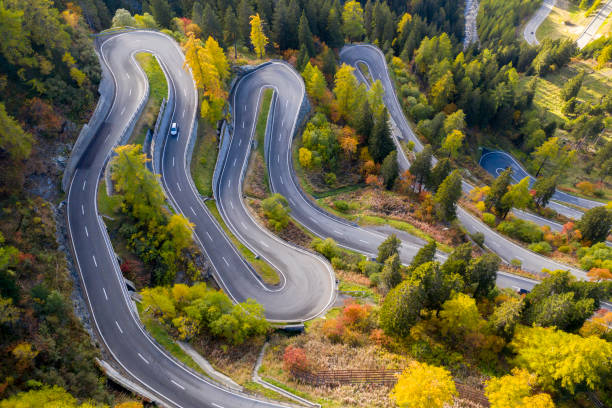
Overview: The Alp Run is one of Europe’s most breathtaking road trips, weaving through the heart of the Alps across Switzerland and neighboring alpine regions. This journey offers a spectacular showcase of towering snow-capped peaks, emerald green valleys, pristine lakes, and charming alpine villages. It’s a road trip that combines natural grandeur with rich cultural experiences — here, winding mountain passes meet world-class cuisine, medieval towns, and the timeless rhythms of mountain life.
Whether you’re crossing iconic passes like the Furka or Grimsel, gazing at the Matterhorn from Zermatt, exploring the deep blue waters of Lake Lucerne, or savoring Swiss chocolate in a village café, the Alp Run delivers constant visual drama. Each curve in the road reveals a new vista, from cascading waterfalls and flower-strewn meadows to jagged ridgelines that seem to touch the sky. The drive is as thrilling as the destinations, making this road trip a perfect blend of adventure, serenity, and cultural richness.
Distance: The distance of the Alp Run varies greatly depending on your chosen route and how many passes and regions you explore. A core loop focusing on Switzerland’s major alpine highlights typically covers around 700 to 1,000 kilometers, or about 435 to 620 miles. Including detours into northern Italy, Austria, or France can easily extend the journey to 1,200 kilometers or more.
Route: Most travelers begin the Alp Run in Zurich or Geneva, both offering excellent international flight connections and car rental options. From Zurich, you can drive south to Lucerne, gateway to the Alps, with its picturesque old town and the shimmering expanse of Lake Lucerne. From there, the route often continues to the Bernese Oberland region, home to iconic peaks such as the Eiger, Mönch, and Jungfrau. Towns like Interlaken, Lauterbrunnen, and Grindelwald offer easy access to stunning mountain scenery and world-renowned hiking trails.
Continuing south, the road leads to Zermatt, where the legendary Matterhorn rises above the valley. Though Zermatt itself is car-free, parking is available in nearby Täsch, with trains providing access to the village. Further east, the route winds through Valais and into the canton of Graubünden, where alpine passes such as the Oberalp and Albula await. Here, the road trip experience reaches its zenith with drives over the Furka, Grimsel, and Gotthard Passes — each a masterpiece of engineering with hairpin turns and panoramic views. Many travelers also extend the route into neighboring Italy’s Aosta Valley or Austria’s Tyrol region to deepen the alpine experience.
Estimated Time to Complete: A minimum of five to seven days allows for a satisfying Alp Run, hitting many of the key highlights and scenic passes. However, a more leisurely ten to fourteen-day itinerary gives you time to explore at a relaxed pace, stay overnight in charming villages, and enjoy excursions such as cable car rides, alpine hikes, and glacier tours. With more time, you can also incorporate cultural stops in Bern, Lausanne, or Chur, and venture into cross-border alpine regions for a more diverse experience.
Things to See on the Way: The Alp Run offers a dazzling array of natural and cultural highlights. In Lucerne, explore the historic Kapellbrücke bridge and take a boat cruise on the lake. The Bernese Oberland provides some of Europe’s most dramatic scenery, with Lauterbrunnen Valley’s 72 waterfalls and the Jungfraujoch railway — the highest train station in Europe. In Zermatt, the Matterhorn dominates the skyline, while scenic hikes and the Gornergrat Railway provide unforgettable views.
Driving the high alpine passes is a highlight in itself; the Furka Pass offers James Bond-worthy switchbacks and sweeping vistas, while the Grimsel and Susten Passes cut through wild, glacier-carved landscapes. Along the way, picturesque towns like Andermatt, Brig, and Davos offer alpine charm, luxury hotels, and traditional Swiss hospitality. For nature lovers, there are countless opportunities for hiking, wildlife spotting, and photography, while cultural enthusiasts can visit mountain museums, ancient churches, and artisan workshops.
Budget: Budgets for the Alp Run vary widely depending on travel style. Switzerland is known for being an expensive destination, and road trips here are no exception. Budget-conscious travelers staying in hostels, guesthouses, or camping can expect to spend around $1,200 to $1,800 USD per person for a week-long trip. A mid-range experience, with comfortable hotels and a mix of casual and fine dining, typically costs between $2,000 and $3,500 USD per person. Luxury travelers, especially those staying in mountain resorts and indulging in guided experiences or gourmet meals, may spend $4,000 USD or more. Key expenses include car rental, fuel, accommodation, mountain transport (cable cars and trains), and meals.
Difficulty: Driving the Alp Run requires confidence and a bit of experience, especially when tackling the high mountain passes. The roads are well-maintained, but many passes feature narrow sections, sharp hairpin turns, and steep gradients. Weather can change quickly at altitude, with fog or snow possible even in summer, so caution is advised. Parking in tourist hotspots can be limited, particularly during peak seasons, and some areas, such as Zermatt, require travelers to use shuttle trains. That said, with careful planning and moderate driving experience, most travelers will find the Alp Run to be an exhilarating but manageable adventure.
Need to Know: Travelers should be aware that mountain roads may open late in the season due to lingering snow — typically around May or June — and can close again by October. Always check the current status of alpine passes before setting out. It’s also important to note that Swiss motorways require a vignette (toll sticker), which is typically included with rental cars, but double-check to be sure. Gas stations are available throughout the region, but in remote mountain areas, fuel can be scarce — it’s wise to top off your tank when possible.
Cell coverage is generally good but can be spotty in deep valleys or high passes. Credit cards are widely accepted, but having some Swiss francs on hand for small towns and rural stops is useful. Finally, while English is spoken in tourist areas, learning a few basic phrases in German, French, or Italian (depending on the canton) will enrich your interactions with locals.
Recommended Vehicle: A comfortable, reliable vehicle with strong braking and handling is essential for the Alp Run. A midsize car or SUV with good visibility is ideal, particularly for navigating mountain passes. In summer, standard two-wheel-drive vehicles are sufficient for most routes, but an all-wheel-drive car adds peace of mind, especially if you’re traveling early or late in the season. In winter, if you plan to drive lower alpine roads or around resort towns, winter tires and AWD are essential — but note that many high passes will be closed and your route will need to adjust accordingly. Comfort and visibility should be prioritized, as much of the joy of the Alp Run comes from the journey itself and the stunning views from the road.
Top Photo Spot: One of the most iconic photo opportunities along the Alp Run is on the Furka Pass, where a dramatic ribbon of road snakes through a sea of towering peaks, glaciers, and alpine meadows. The viewpoint near the historic Belvédère Hotel offers a particularly breathtaking composition — the perfect image to capture the spirit of adventure and grandeur that defines this unforgettable road trip through the Alps.
10.) North Coast 500 (Scotland)

Overview: The North Coast 500, often called Scotland’s ultimate road trip, is a spectacular circular route that takes travelers through the wild and rugged landscapes of the Scottish Highlands. Starting and ending in Inverness, this 830-kilometer journey unveils a land of towering mountains, windswept coastlines, ancient castles, misty lochs, and timeless villages. The NC500 offers not only breathtaking scenery but also a deep sense of history and cultural richness, where every glen and ruin whispers stories of Scotland’s past.
Driving the North Coast 500 is about embracing the slow rhythm of the Highlands. The route winds through some of the UK’s most remote and unspoiled regions, where single-track roads lead to hidden beaches, dramatic sea cliffs, and tiny crofting communities. Along the way, travelers encounter abundant wildlife — red deer, puffins, seals, dolphins — and warm Highland hospitality in rustic inns and local pubs. Whether it’s the haunting beauty of Suilven rising from the mist or the golden sands of Balnakeil Beach, the NC500 delivers a road trip experience that is as soulful as it is scenic.
Distance: The North Coast 500 loop covers approximately 830 kilometers, or about 516 miles. Though not a vast distance by road trip standards, the twisting, often narrow roads of the Highlands mean that progress is naturally slow, encouraging travelers to savor each stretch of the journey.
Route: The route begins in Inverness, the capital of the Highlands, and typically proceeds in a clockwise or counterclockwise loop. Heading north, drivers follow the rugged east coast through the historic towns of Dornoch, Tain, and Wick, passing dramatic sea cliffs and castles perched above the North Sea. Turning west at John o’Groats, the route enters Caithness and Sutherland, where vast moorlands meet sweeping coastal views.
The western section of the NC500 is perhaps the most awe-inspiring. Here, the road twists through the wild and mountainous regions of Assynt and Wester Ross, with iconic peaks like Suilven and Stac Pollaidh dominating the landscape. The coastline becomes increasingly dramatic, with white-sand beaches such as Achmelvich and Balnakeil offering unexpected beauty. The route eventually curves south along Loch Maree and Torridon, passing through postcard-perfect villages such as Applecross and Shieldaig, before returning to Inverness via the more gentle landscapes of the Inner Moray Firth.
Estimated Time to Complete: While it is possible to complete the NC500 in four to five days, doing so would mean sacrificing many of the unique experiences and side trips that make this route so special. A more rewarding itinerary spans seven to ten days, allowing time for detours, hikes, cultural visits, and lingering in favorite spots. Some travelers choose to extend their trip further, combining the NC500 with exploration of the Isle of Skye or the Cairngorms National Park for an even deeper dive into Highland beauty.
Things to See on the Way: The NC500 is filled with unforgettable sights. Along the east coast, Dunrobin Castle enchants with its fairy-tale turrets and lavish gardens, while the Whaligoe Steps descend a cliffside to a historic harbor. At the northern tip, John o’Groats and nearby Duncansby Head offer windswept cliffs and sea stacks teeming with seabirds.
In the northwest, the landscape becomes wilder and more dramatic. The mountains of Assynt are a highlight, with peaks such as Suilven, Quinag, and Canisp rising from a primordial landscape. The beaches of the west coast, including Sandwood Bay and Balnakeil, are among the finest in the UK, with vast expanses of sand and turquoise waters. The remote road through Wester Ross passes through ancient Caledonian forests and beneath towering peaks. Further south, the Applecross Peninsula delivers one of Scotland’s most thrilling drives over the Bealach na Bà, a twisting mountain pass with hairpin bends and staggering views. Throughout the journey, travelers encounter ancient brochs, standing stones, cozy pubs, and vibrant local communities that bring Highland culture to life.
Budget: Budgets for an NC500 trip can vary widely depending on the season and level of comfort desired. Budget travelers staying in hostels, campsites, or budget B&Bs can complete the route for around £600 to £1,000 per person for a week-long trip. Mid-range travelers, choosing comfortable guesthouses, boutique hotels, and a mix of casual and fine dining, might spend between £1,200 and £2,000 per person. Luxury travelers opting for premium accommodations, gourmet meals, and guided experiences can expect to spend £2,500 or more. Car rental, fuel, food, and accommodation will be the main expenses, with guided tours or specialized activities such as wildlife cruises adding to the budget.
Difficulty: Driving the NC500 is generally accessible for most travelers, but it does come with some challenges. Many of the most scenic sections, especially in the west, involve single-track roads with passing places. Drivers unfamiliar with such conditions should proceed slowly and courteously, giving way to oncoming traffic and allowing locals to pass. Weather in the Highlands can change rapidly, bringing fog, rain, and strong winds even in summer, so caution is advised. During peak tourist season, popular stops can become busy, and advance booking of accommodations is essential. With mindful driving and a flexible itinerary, the NC500 is a thrilling yet approachable road trip.
Need to Know: Travelers should be prepared for limited services in remote areas — fuel stations and grocery stores can be far apart, so it’s wise to plan ahead and keep supplies topped up. Mobile phone coverage is generally good near towns but can be patchy in remote stretches, especially in the northwest. Scotland’s right-to-roam laws allow respectful access to the land, but visitors should take care to preserve the environment, stick to marked paths, and leave no trace.
Parking can be limited at popular viewpoints, and wild camping, while legal, should be done responsibly and in line with local guidelines. Bealach na Bà is an exhilarating drive but not suitable for large vehicles or inexperienced drivers in poor weather. Finally, embrace the slow pace of the Highlands — this is a road trip to savor, not rush.
Recommended Vehicle: A comfortable and reliable car is perfectly suitable for the NC500. A compact or midsize vehicle is often ideal for navigating single-track roads and narrow lanes. While a standard two-wheel-drive car is sufficient for summer travel, a vehicle with good clearance and handling adds confidence when tackling rougher sections or poor weather. In winter or shoulder seasons, be prepared for icy conditions and consider a vehicle with winter tires or all-wheel drive if necessary. Those planning to camp or travel independently may opt for a campervan, but be mindful of road restrictions and parking limitations in certain areas.
Top Photo Spot: One of the most iconic photo spots along the NC500 is atop the Bealach na Bà pass, where the winding road descends toward the Applecross Peninsula against a backdrop of towering mountains and the sea beyond. On a clear day, views extend across to the Isle of Skye and the Outer Hebrides, capturing the wild, elemental beauty that defines the Scottish Highlands and makes this road trip unforgettable.
11.) Great Ocean Road (Australia)
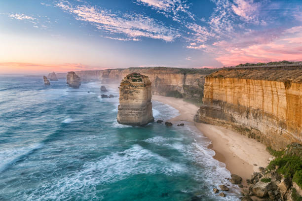
Overview: Australia’s Great Ocean Road is one of the world’s most iconic coastal drives — a breathtaking journey that hugs the rugged southern coast of Victoria, revealing dramatic cliffs, windswept beaches, lush rainforests, and charming seaside towns. Originally built by returned soldiers as a memorial to their fallen comrades of World War I, the road itself is steeped in history, making the journey as meaningful as it is beautiful.
Stretching along the edge of the continent, the Great Ocean Road offers an ever-changing panorama where the raw power of the Southern Ocean meets the ancient landscape of Australia’s temperate rainforest. The route’s highlights include towering limestone stacks such as the Twelve Apostles, tranquil coves, koala-filled eucalypt forests, and verdant national parks. Whether you’re driving under golden skies at sunrise or watching the sea crash against the cliffs at dusk, this is a road trip that speaks to both the senses and the soul.
Distance: The official length of the Great Ocean Road is approximately 243 kilometers, or about 151 miles, stretching from Torquay to Allansford. However, many travelers begin their journey in Melbourne and incorporate additional side trips, often extending the total distance covered to 400 to 500 kilometers or more, depending on the itinerary.
Route: The classic route begins in Torquay, Australia’s surfing capital, just over an hour’s drive southwest of Melbourne. From here, the road hugs the coast, passing through a series of charming beach towns such as Anglesea and Lorne. This eastern section is renowned for its dramatic sea cliffs and iconic surf beaches, including the legendary Bells Beach.
As the road winds westward, it enters the lush Great Otway National Park, a region of towering eucalypt forests, hidden waterfalls, and prehistoric tree ferns. Detours into the Otways offer chances to spot koalas, walk through ancient rainforest, and experience Australia’s wild interior. Emerging from the forest, the route returns to the coast at the Shipwreck Coast, where the Twelve Apostles rise majestically from the sea — one of the most photographed sights in Australia. Beyond the Apostles, the road continues past Loch Ard Gorge, the London Arch, and other geological wonders before reaching Allansford and the regional city of Warrnambool. Many travelers choose to return inland via the Princes Highway, completing the loop back to Melbourne.
Estimated Time to Complete: The Great Ocean Road can technically be driven in a single, long day, but doing so would rob you of much of its magic. A comfortable itinerary typically spans two to three days, allowing time for coastal walks, wildlife spotting, and overnight stays in character-filled towns such as Apollo Bay or Port Campbell. Extending the trip to four or five days provides opportunities for deeper exploration — hiking in the Otways, whale watching in Warrnambool, or relaxing on the beaches of the Surf Coast. The flexibility of a self-drive trip makes it easy to adapt the journey to your pace and interests.
Things to See on the Way: The Twelve Apostles are undoubtedly the marquee attraction of the Great Ocean Road — towering limestone stacks rising from the crashing waves. Viewing them at sunrise or sunset offers a truly magical experience, with ever-changing colors on the sea and stone. Nearby, Loch Ard Gorge tells the dramatic story of a famous shipwreck, while other natural wonders such as the Gibson Steps, the Arch, and the Grotto showcase the erosive power of the ocean.
Inland, Great Otway National Park provides a stark contrast to the coastal scenery, with misty rainforests, hidden waterfalls like Hopetoun Falls, and abundant wildlife. Koalas are frequently spotted along the stretch of road between Kennett River and Lorne. The town of Apollo Bay is a favorite stop for its relaxed vibe, seafood restaurants, and proximity to forest walks. On the eastern section of the drive, Bells Beach and Torquay offer a taste of Australia’s legendary surf culture, with opportunities to watch world-class surfers or visit the Australian National Surfing Museum. The entire route is rich with scenic lookouts, charming villages, and coastal trails, making it a journey best savored slowly.
Budget: The Great Ocean Road can accommodate a wide range of travel budgets. Budget-conscious travelers staying in hostels or campgrounds and self-catering meals can complete a two- to three-day trip for around $300 to $500 AUD per person. A mid-range experience, with stays in comfortable hotels or B&Bs and meals at local restaurants, typically costs between $600 and $1,200 AUD per person. Luxury travelers, choosing boutique accommodations, fine dining, and guided tours, might spend $1,500 AUD or more. Major expenses include car rental, fuel, accommodation, and meals, with optional costs for guided experiences such as helicopter flights over the Apostles.
Difficulty: Driving the Great Ocean Road is generally straightforward and well within the capabilities of most travelers. The road is sealed, well-maintained, and clearly signposted, though it does feature many curves and coastal bends that require attentive driving. During weekends and holiday periods, the road can become busy, and parking at popular viewpoints may be limited. Travelers should drive cautiously and allow plenty of time for stops and photo opportunities. Wildlife, particularly kangaroos and koalas, may appear near the road, especially at dawn and dusk, so vigilance is essential.
Need to Know: The Great Ocean Road is a popular route year-round, with the summer months (December to February) drawing the largest crowds. If possible, visiting in the shoulder seasons of spring or autumn offers a more tranquil experience with milder weather. Accommodations in key towns such as Apollo Bay and Port Campbell can book up early in peak season — advance reservations are recommended.
Fuel stations and facilities are available throughout the route, but it is wise to refuel before entering the more remote sections near the Shipwreck Coast. Mobile phone coverage is generally reliable, though occasional black spots exist in forested or remote areas. Australian road rules require driving on the left side of the road, and international visitors should take time to adjust to local conditions. Above all, respect the natural environment — stay on designated trails, observe wildlife from a distance, and take care not to disturb fragile coastal ecosystems.
Recommended Vehicle: A standard two-wheel-drive car is perfectly suitable for the Great Ocean Road. The route is entirely paved and accessible to all vehicle types. A small or midsize car offers the best flexibility for parking and navigating the road’s many bends, while those planning to camp or explore more of the Otways might consider a campervan for added convenience. During winter, be prepared for occasional rain and wet roads, but no special vehicle requirements are needed. Comfortable seating and good visibility are important, as much of the joy of this road trip lies in the ever-changing views of sea and sky.
Top Photo Spot: The viewing platforms overlooking the Twelve Apostles provide the most iconic photo opportunity on the Great Ocean Road. Framed by towering cliffs and the endless expanse of the Southern Ocean, the Apostles are a photographer’s dream — especially at sunrise or sunset when the light plays across their weathered faces. For an alternative angle, consider a helicopter flight for a bird’s‑eye view of this dramatic coastline, capturing the scale and grandeur of one of Australia’s most remarkable natural landmarks.
12.) Garden Route (South Africa)
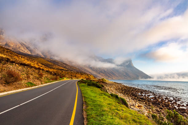
Overview: The Garden Route is one of South Africa’s most famous and scenic road trips, weaving its way along the southeastern coast between Cape Town and Port Elizabeth. This lush and diverse stretch of coastline is renowned for its stunning natural beauty, featuring rolling hills, indigenous forests, sparkling lagoons, and pristine beaches. The Garden Route is not just a drive but a journey through a rich tapestry of landscapes and vibrant towns that perfectly blend adventure, culture, and relaxation.
Travelers along the Garden Route experience a unique mix of outdoor activities — from whale watching and bungee jumping to hiking and kayaking — alongside charming towns steeped in history and warm local hospitality. With its mild climate and well-maintained roads, the Garden Route is an accessible yet unforgettable trip that offers a little something for everyone, from nature lovers and thrill seekers to foodies and culture enthusiasts.
Distance: The Garden Route covers roughly 300 kilometers, or about 186 miles, stretching from the town of Mossel Bay in the Western Cape to Storms River in the Eastern Cape. Many travelers extend the journey further to include nearby towns like Knysna and Plettenberg Bay, creating a richer itinerary that can cover between 400 and 500 kilometers depending on side trips and detours.
Route: Starting in Mossel Bay, the route heads east along the N2 highway, tracing a path close to the Indian Ocean coast. Early stops include Wilderness and Sedgefield, where tranquil lagoons and golden beaches invite relaxation. Continuing to Knysna, the route passes through verdant forests and sweeping views of the Knysna Lagoon, a jewel of the region. From Knysna, travelers can explore the nearby Tsitsikamma National Park, famous for its indigenous forests, suspension bridges, and dramatic coastline.
The Garden Route continues east to Plettenberg Bay, known for its beautiful beaches and marine life, before reaching the Storms River area, a gateway to further adventures in the Eastern Cape. Along the way, travelers can detour to smaller towns, game reserves, and nature reserves that showcase South Africa’s remarkable biodiversity. The road is easy to navigate and well signposted, offering a smooth and scenic driving experience.
Estimated Time to Complete: Though the Garden Route can be driven in two to three days, this quick pace leaves little time to explore its many highlights. Most travelers allow four to six days to fully enjoy the journey, including outdoor activities like hiking, wildlife viewing, and water sports, as well as indulging in local cuisine and cultural experiences. For those seeking a deeper immersion, extending the trip to a week or more opens up additional adventures like visiting nearby safari lodges or exploring coastal towns beyond the traditional route.
Things to See on the Way: The Garden Route’s diverse landscapes are packed with unforgettable sights. Knysna’s waterfront is a lively hub with restaurants, markets, and views of the lagoon, while nearby Featherbed Nature Reserve offers guided walks and boat trips amid pristine nature. Tsitsikamma National Park boasts the famous suspension bridge over the Storms River Mouth and a network of hiking trails through ancient forests.
Marine life enthusiasts will delight in Plettenberg Bay’s opportunities for whale watching, dolphin spotting, and snorkeling with seals. Along the coast, numerous beaches provide perfect spots for swimming, surfing, or simply soaking in the sun. Inland, game reserves such as Gondwana and Botlierskop offer safari experiences with South Africa’s iconic wildlife. The Garden Route also features rich cultural stops, from indigenous art galleries to historic towns like Knysna and Mossel Bay, where early explorers first landed.
Budget: Travel budgets for the Garden Route vary depending on style and activities. Budget travelers staying in hostels, guesthouses, or campgrounds and self-catering meals can complete a four- to six-day trip for approximately 5,000 to 8,000 ZAR (South African Rand) per person. Mid-range travelers opting for comfortable hotels, guided tours, and dining out can expect to spend between 10,000 and 18,000 ZAR. Luxury travelers choosing high-end lodges, private safaris, and gourmet cuisine may spend upwards of 25,000 ZAR or more. Main expenses include car rental, accommodation, park entrance fees, and meals, with activities such as bungee jumping or safari drives adding to the cost.
Difficulty: The Garden Route is widely regarded as an easy to moderate road trip for drivers of all experience levels. The main roads are paved and well-maintained, with clear signage and multiple services along the way. While some coastal sections feature winding roads and occasional hills, the driving is generally straightforward. Travelers should be aware of local driving rules in South Africa, including driving on the left side of the road and paying attention to speed limits and wildlife crossings. In rural areas and national parks, caution is advised due to the presence of animals and narrower roads. Weather is mild year-round but can vary, so it’s wise to check forecasts and prepare accordingly.
Need to Know: Visitors should plan ahead for popular times such as school holidays and summer months (December to February), when accommodation and attractions can be busy. Booking in advance is recommended to secure preferred lodgings and activities. Fuel stations and services are widely available but less frequent in remote areas, so topping up regularly is a good habit. Mobile coverage is generally reliable along the route but may be patchy in some forested or mountainous sections. Respect for local communities and natural habitats is essential — visitors should adhere to park rules, avoid littering, and support responsible tourism initiatives.
Travelers from abroad should ensure their driver’s license is valid for South African roads and consider obtaining an International Driving Permit if required. Safety is generally good along the Garden Route, but usual travel precautions apply, especially when driving at night or in isolated areas.
Recommended Vehicle: A standard two-wheel-drive vehicle is suitable for the Garden Route, with most travelers opting for a comfortable sedan, SUV, or compact car. The roads are mostly sealed and easy to navigate, but a higher clearance vehicle may be preferred for some detours or excursions into nature reserves. For those planning to camp or explore more remote areas, a campervan or 4x4 rental can offer flexibility and convenience. Regardless of the vehicle choice, good visibility and reliable air conditioning can enhance comfort on longer driving days.
Top Photo Spot: One of the Garden Route’s most breathtaking photo locations is the viewpoint overlooking the Knysna Heads — two towering sandstone cliffs guarding the entrance to Knysna Lagoon. The dramatic contrast of deep blue water framed by rugged cliffs, often bathed in soft morning or late afternoon light, creates a picture-perfect scene emblematic of the region’s natural beauty. Nearby beaches, forest trails, and the suspension bridge at Tsitsikamma also offer fantastic photo opportunities.
13.) Pacific Coast Highway / Highway 1 (California, USA)

Overview: The Pacific Coast Highway, also known as Highway 1, is an iconic American road trip that stretches along California’s rugged coastline, offering some of the most breathtaking ocean views in the world. From the towering redwoods in the north to the sunny beaches of Southern California, this route captures the diverse beauty and laid-back spirit of the Golden State. It’s a journey that blends dramatic cliffs, quaint seaside towns, state parks, and endless Pacific vistas into one unforgettable experience.
Driving Highway 1 feels like stepping into a postcard, with every turn revealing a new panorama of crashing waves, windswept beaches, and iconic landmarks. Whether you’re stopping to explore the charming town of Carmel-by-the-Sea, walking along the historic pier in Santa Barbara, or marveling at the rugged coastline of Big Sur, the Pacific Coast Highway is an adventure that captures the heart of California’s natural and cultural heritage.
Distance: The official length of Highway 1 varies depending on where you start and end, but the most popular stretch runs approximately 740 kilometers (about 460 miles) from Leggett in Northern California down to Dana Point in Southern California. Many travelers focus on the scenic section between San Francisco and Los Angeles, which covers roughly 650 kilometers (around 400 miles).
Route: Starting in the north near the town of Leggett, Highway 1 winds through the towering redwood forests before descending toward the coast at Mendocino. The route then follows the jagged shoreline southward through charming coastal towns like Fort Bragg and Jenner. As you continue, the highway enters the legendary Big Sur region, renowned for its dramatic cliffs, waterfalls, and forested mountains meeting the ocean in spectacular fashion.
Beyond Big Sur, the road leads to the picturesque town of Carmel-by-the-Sea and the artistic hub of Monterey, where the famous 17-Mile Drive offers additional coastal views. The route then continues along the coast to Santa Barbara, often called the “American Riviera” for its Mediterranean climate and beautiful architecture. The southern terminus near Dana Point provides access to Southern California’s beaches and cities, including Los Angeles. Along the way, there are countless pullouts, parks, and scenic overlooks inviting travelers to pause and take in the stunning surroundings.
Estimated Time to Complete: While it’s possible to drive the Pacific Coast Highway in a single day, doing so would mean missing the magic of many of its stops. A relaxed pace usually requires four to seven days, allowing time to explore the natural wonders, towns, and beaches along the way. Some travelers choose to break the trip into smaller segments, focusing on areas like the Redwood Coast, Big Sur, or the stretch from Santa Barbara to Los Angeles. Planning overnight stays in coastal towns provides a chance to enjoy local cuisine, shops, and the unique vibe of each community.
Things to See on the Way: Big Sur stands out as the crown jewel of Highway 1, with landmarks like Bixby Creek Bridge, McWay Falls, and Pfeiffer Beach offering unforgettable photo opportunities. The nearby Ventana Wilderness invites hiking and wildlife spotting, while Hearst Castle in San Simeon reveals a glimpse of California’s glamorous past.
Monterey’s world-famous aquarium and the 17-Mile Drive through Pebble Beach are perfect for families and nature lovers alike. In Santa Barbara, Spanish colonial architecture meets palm-lined streets and excellent wine tasting rooms. Along the coast, beaches such as Pismo Beach and Zuma Beach provide perfect spots to relax, surf, or watch stunning sunsets. Whale watching is a popular activity, especially during migration seasons. The route is rich with state parks, gardens, and quirky roadside attractions that make every stop unique.
Budget: Costs for traveling the Pacific Coast Highway can vary widely. Budget travelers who camp or stay in budget motels and cook their own meals can manage a multi-day trip for around $500 to $800 USD per person. Mid-range travelers staying in comfortable hotels or inns and dining at local restaurants might spend between $1,200 and $2,000 USD. Luxury travelers opting for boutique hotels, gourmet dining, and private tours can expect to pay $3,000 USD or more. Major expenses include car rental, accommodation, food, entrance fees to attractions, and optional guided tours or activities like whale watching or helicopter rides.
Difficulty: Driving Highway 1 requires careful attention due to its winding, often narrow roads along cliffs and steep drop-offs. While the route is paved and generally well-maintained, some stretches are subject to closures or delays due to landslides or road repairs, especially in the Big Sur area. Drivers should be comfortable with twisty roads and allow extra time for sightseeing stops. Passing lanes are limited, and slower vehicles can be common. Weather conditions can change rapidly near the coast, with fog and wind reducing visibility at times. Caution is essential, especially during early morning or late evening driving.
Need to Know: The Pacific Coast Highway is extremely popular during summer and holidays, which can result in heavy traffic and crowded accommodations. Booking lodging well in advance is highly recommended, especially in Big Sur and popular towns like Carmel and Santa Barbara. Some campgrounds and state parks require reservations months ahead. Cell phone coverage is generally good along the route, but some remote stretches, particularly in Big Sur, may have limited signal. There are gas stations in most towns, but fueling up before entering long rural sections is wise. California’s road rules require driving on the right side, and seat belts are mandatory. Be prepared for changing weather and always check road conditions before traveling, particularly in winter or after storms.
Recommended Vehicle:A standard passenger car or SUV is suitable for the Pacific Coast Highway. The roads are fully paved, but a vehicle with good handling and reliable brakes is advisable due to the many curves and elevation changes. Convertibles or cars with panoramic roofs are popular for those wanting to maximize views, but keep in mind the frequent coastal winds. Motorcycles are also a favored choice for experienced riders seeking an exhilarating ride. Larger RVs and trailers may face challenges on narrower or more winding sections, so careful route planning is necessary for those vehicles.
Top Photo Spot: The Bixby Creek Bridge in Big Sur is one of the most photographed landmarks on the Pacific Coast Highway, perfectly capturing the grandeur of the rugged coastline with its elegant concrete arch spanning a deep canyon. Sunrise and sunset light create dramatic shadows and warm hues, making it a must-stop for photographers. Other spectacular photo spots include McWay Falls cascading directly onto the beach, the rocky shorelines at Pfeiffer Beach, and the panoramic views from various lookout points along the 17-Mile Drive.
14.) Cabot Trail (Nova Scotia, Canada)
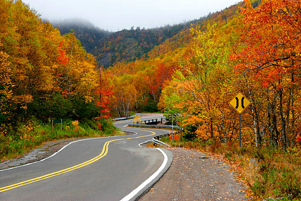
Overview: The Cabot Trail is a world-renowned scenic drive that loops through the Cape Breton Highlands in Nova Scotia, Canada. Known for its dramatic ocean cliffs, lush forests, and vibrant Celtic culture, this route offers a perfect blend of natural beauty and cultural richness. Driving the Cabot Trail is like journeying through a living postcard, with panoramic views of the Atlantic Ocean on one side and dense highland forests on the other. It’s a chance to experience some of Canada’s most breathtaking landscapes, traditional music, and warm hospitality.
This trail is not just about the drive but also about immersing yourself in the culture and outdoor adventures of Cape Breton Island. Visitors can explore hiking trails, sample fresh seafood, and enjoy festivals celebrating Gaelic heritage. The Cabot Trail provides an authentic Canadian maritime experience, showcasing rugged coastlines, charming fishing villages, and the wildlife of the highlands, making it an unforgettable trip for nature lovers and culture seekers alike.
Distance: The full Cabot Trail loop covers approximately 298 kilometers, or about 185 miles. This circular route begins and ends in the town of Baddeck, making it easy to plan a round-trip journey. Depending on side trips and detours, travelers may cover a bit more ground exploring nearby attractions and communities along the way.
Route: Starting in Baddeck, the trail follows the coast north through the Cape Breton Highlands National Park, offering breathtaking ocean views and opportunities to spot wildlife such as moose and eagles. The route continues to the town of Cheticamp, a lively Acadian fishing village where visitors can experience French Canadian culture and fresh lobster dishes.
From Cheticamp, the trail curves east and then south, passing through charming communities like Pleasant Bay and Ingonish, each offering unique access to hiking trails, beaches, and cultural sites. The route eventually loops back to Baddeck, weaving through rolling hills, dense forests, and scenic coastal vistas. The Cabot Trail is well marked and maintained, with plenty of spots to pull over and enjoy the views or take a hike.
Estimated Time to Complete: The Cabot Trail can technically be driven in a single day, but this is highly discouraged due to the wealth of sights and activities along the way. Most travelers spend three to five days exploring the route, allowing time for hiking, wildlife watching, cultural experiences, and relaxing in local towns. This pace provides a more immersive experience, letting visitors soak in the natural beauty and vibrant communities without rushing.
Things to See on the Way: The highlight of the Cabot Trail is the Cape Breton Highlands National Park, with its scenic hiking trails such as the Skyline Trail, which offers spectacular cliffside views of the Gulf of St. Lawrence. Visitors can also enjoy whale watching excursions from Pleasant Bay, where the rich waters are home to several whale species.
The trail passes through the Acadian village of Cheticamp, where local craft shops, seafood shacks, and music festivals celebrate the area’s French heritage. Ingonish Beach is perfect for swimming or picnicking, and nearby coastal trails offer chances to spot seabirds and seals. Along the route, look for historical sites, artisan workshops, and opportunities to hear traditional Celtic music, all contributing to the Cabot Trail’s rich cultural fabric.
Budget: Travelers on a budget can experience the Cabot Trail affordably by staying in campgrounds or budget inns and enjoying local diners and markets. A modest trip might cost around 600 to 1,000 CAD per person for several days, including accommodation, food, and activities. Mid-range visitors staying in comfortable lodges or bed and breakfasts and dining at local restaurants can expect to spend between 1,200 and 2,000 CAD. For those seeking luxury accommodations, guided tours, or gourmet dining experiences, budgets of 3,000 CAD or more are typical. Costs generally include car rental, park entry fees, accommodation, meals, and optional excursions like whale watching.
Difficulty: The Cabot Trail is considered a moderate drive, suitable for most drivers including those with average experience. The roads are paved and well maintained, but the route includes many winding sections, sharp curves, and elevation changes through mountainous terrain. Drivers should be comfortable navigating these twists and allow extra time for slower vehicles or sightseeing stops. Weather can be variable, especially in spring and fall, so preparedness for rain and cooler temperatures is advised. Wildlife crossing the road can be a hazard, so caution is recommended, especially at dawn and dusk.
Need to Know: The best time to drive the Cabot Trail is between late spring and early fall, with summer offering the warmest weather and most festival activity. Fall brings spectacular autumn foliage, drawing many visitors, so booking accommodations early during this peak season is essential. Cell phone reception is generally good in towns but can be spotty in remote areas or within the national park. Fuel stations are available in larger towns but may be limited in between, so it’s wise to keep your tank topped up. Respect for local communities and natural environments is important, so travelers should follow park regulations, avoid littering, and support local businesses.
Visitors from outside Canada should ensure their driver’s license is valid for Canadian roads, and an International Driving Permit may be recommended. Safety on the road is generally good, but always remain vigilant for wildlife and changing weather conditions.
Recommended Vehicle: A standard passenger car or SUV is suitable for the Cabot Trail. The paved roads are accessible to most vehicles, but an SUV or higher clearance car can provide added comfort on hillier sections and in adverse weather. For those planning outdoor adventures or camping, a vehicle with sufficient space for gear and supplies is beneficial. Motorhomes and campervans are also popular options for those wishing to combine travel and accommodation. Regardless of the vehicle, good brakes and reliable tires are important due to the winding nature of the route.
Top Photo Spot: One of the most iconic photo spots on the Cabot Trail is the Skyline Trail lookout, where sweeping views of the Gulf of St. Lawrence stretch to the horizon from dramatic cliffs. The sunset here can be especially spectacular, casting warm light across the water and hills. Other notable photo locations include the colorful fishing village of Cheticamp, the rugged coastline near Ingonish, and the scenic overlooks throughout Cape Breton Highlands National Park.
15.) Leh-Manali Highway (India)
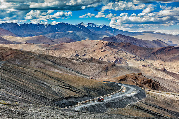
Overview: The Leh-Manali Highway is one of the most thrilling and scenic road trips in the world, cutting through the rugged Himalayas in northern India. Connecting the bustling town of Manali in Himachal Pradesh to the high-altitude desert town of Leh in Ladakh, this route offers an epic adventure across some of the planet’s most dramatic mountain landscapes. The highway takes travelers over multiple high mountain passes, glacial valleys, and stark deserts, providing a unique glimpse into the culture, geography, and resilience of the Himalayan people.
This road trip is not just about the drive but also about experiencing the raw power and beauty of the Indian Himalayas. Along the way, you’ll encounter remote villages, ancient Buddhist monasteries, and breathtaking vistas of snow-capped peaks. It’s a journey that challenges both your spirit and senses, blending adventure, spirituality, and natural wonder in an unforgettable Himalayan odyssey.
Distance: The Leh-Manali Highway stretches approximately 475 kilometers (295 miles) between Manali and Leh. Though the distance may seem manageable, the road conditions, high altitude, and terrain make the journey a slow and demanding experience.
Route: Starting in Manali, the highway ascends rapidly into the mountains, passing through the Kullu Valley before reaching the Rohtang Pass, a gateway to the trans-Himalayan region. From there, the road continues through the Lahaul Valley, following the Chandra River, and climbs up to several high mountain passes including Baralacha La and Lachulung La. The route crosses desolate, stark landscapes dotted with ancient gompas (Buddhist monasteries) and small villages that offer a glimpse into Ladakhi culture.
The highway eventually descends into the Indus River valley before reaching Leh, the capital of Ladakh. The road is mostly unpaved or gravel for large stretches, especially at higher altitudes, making it a challenging drive but one filled with unforgettable vistas of Himalayan peaks, turquoise lakes, and sweeping valleys.
Estimated Time to Complete: Due to the challenging terrain, unpredictable weather, and the need for acclimatization to high altitudes, most travelers take between four to seven days to complete the Leh-Manali Highway trip. Driving too quickly can be dangerous because of altitude sickness risks and rough road sections, so a slow, steady pace with overnight stops in key villages like Keylong, Sarchu, and Pang is recommended.
Things to See on the Way: This journey offers an array of spectacular sights. Rohtang Pass is a popular stop for panoramic mountain views and snow activities in summer. The Chandratal Lake, often called the “Moon Lake,” is a striking turquoise gem nestled among barren peaks, perfect for camping and photography. Along the way, you can visit ancient monasteries such as Key Monastery and Thiksey Monastery, which are centers of Buddhist culture and history.
The dramatic landscapes of the high mountain passes—Baralacha La, Nakee La, and Lachulung La—offer some of the highest drivable roads in the world, with stunning views over rocky, moon-like terrain. Wildlife enthusiasts might spot Himalayan blue sheep, marmots, and rare birds in the national parks adjacent to the highway. Leh itself is a cultural hub, with bustling bazaars, traditional handicrafts, and historic sites such as the Leh Palace.
Budget:Traveling the Leh-Manali Highway is generally considered a mid- to high-budget adventure, mostly due to the costs of vehicle rental (preferably a sturdy SUV or bike), fuel, permits, accommodation, and food in remote areas. Budget travelers relying on tents or basic guesthouses might manage with around 15,000 to 25,000 INR (~200 to 330 USD) for a week. More comfortable travelers staying in mid-range hotels and hiring local guides or vehicles can expect costs upwards of 35,000 to 50,000 INR (~470 to 670 USD). Luxury options with private tours, deluxe hotels, and personalized services are also available at a higher cost.
Difficulty: The Leh-Manali Highway is one of the most challenging road trips in the world. Drivers must be experienced and prepared for narrow mountain roads, sharp bends, gravel and dirt surfaces, and rapidly changing weather conditions. High altitude presents risks of acute mountain sickness, so acclimatization is essential. The highway is generally open only from late May to early October due to heavy snowfall in winter closing the route. Travelers must be vigilant for landslides, road washouts, and occasional traffic delays caused by construction or weather. Physical fitness and mental preparedness are critical for this journey.
Need to Know: Before attempting the Leh-Manali Highway, travelers should check road conditions and weather forecasts, as landslides or snowstorms can cause sudden closures. Permits are required to enter certain areas in Ladakh and must be obtained in advance or at entry points. Cell phone reception is limited and often unavailable in remote mountain sections. Fuel stations are sparse, so refueling whenever possible is crucial. Travelers are advised to carry warm clothing, basic medical supplies, and high-energy food for the road. Acclimatization days in Manali or Keylong are highly recommended to prevent altitude sickness.
Insurance for health and travel emergencies is a must, and a reliable vehicle with good ground clearance and sturdy tires is essential. It’s wise to travel in groups or with a local driver/guide if unfamiliar with Himalayan driving conditions. Respect for local culture and environment is important throughout the journey.
Recommended Vehicle: A sturdy four-wheel-drive SUV or a well-maintained motorcycle (like a Royal Enfield) is recommended for the Leh-Manali Highway. The rough, unpaved stretches and steep inclines require vehicles with good ground clearance and traction. Many travelers opt for motorbikes for the freedom and thrill of the ride, but this demands riding experience and caution at altitude. Renting vehicles in Manali is common, and guided tours often provide reliable transportation options. Sedans or low-clearance cars are not recommended due to road conditions.
Top Photo Spot: One of the most iconic photo spots on the Leh-Manali Highway is the stretch near Rohtang Pass, where snow-capped peaks rise dramatically against wide-open skies. Another unforgettable location is Chandratal Lake, whose brilliant turquoise waters contrast sharply with the barren surrounding mountains. The high mountain passes, like Baralacha La and Lachulung La, provide otherworldly backdrops of rocky moonscapes and sweeping valleys that are perfect for dramatic photos. Early morning or late afternoon light creates striking shadows and enhances the rugged textures of the landscape.
16.) Atlantic Ocean Road (Norway)
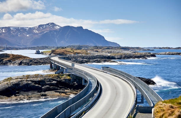
Overview: The Atlantic Ocean Road (Atlanterhavsveien) is one of Europe’s most iconic and visually striking road trips, famed for its dramatic curves, arched bridges, and spectacular views of the Norwegian Sea. Stretching along Norway’s rugged western coastline, this short but exhilarating route connects a series of islands between the towns of Kristiansund and Bud, skimming just above the roaring waves and often engulfed in coastal mist or sunshine.
While the road itself is only 8.3 kilometers long, it offers a concentrated dose of natural beauty and human engineering, winding across low-lying bridges and causeways that appear to leap from island to island. It’s a favorite among photographers, road trippers, and thrill-seekers who come to experience its storm-battered drama or tranquil serenity, depending on the season and weather.
This road trip isn’t just about the drive—it’s about embracing Norway’s raw coastal elements. With stops for hiking, fishing, and historical landmarks along the way, the Atlantic Ocean Road offers a deep connection to Norway’s maritime heritage and natural splendor.
Distance: The Atlantic Ocean Road itself covers approximately 8.3 kilometers (5.2 miles), but most road trippers expand the journey into a full-day or multi-day excursion along the Kristiansund–Bud coastal route, totaling around 70–80 kilometers depending on detours and side trips.
Route: The route typically begins in Kristiansund, a vibrant coastal town known for its harbor, seafood, and colorful architecture. From there, travelers head south on the Rv64 highway, passing through the Atlantic Ocean Tunnel before reaching the start of the scenic drive.
The main stretch of the Atlantic Ocean Road runs between the islands of Averøy and Vevang, connected by a series of eight bridges, the most famous of which is the Storseisundet Bridge, known for its dramatic curve and optical illusion of dropping into the sea. The road hugs the coastline, with frequent pull-offs and viewing platforms for panoramic shots.
From there, the route continues to Bud, a charming fishing village that marks the western end of the drive. Optional detours include hiking trails, stave churches, and coastal fortresses, adding depth to the short but rich road trip.
Estimated Time to Complete: Though the road is short, most travelers spend 2 to 4 hours exploring it thoroughly, including photo stops, walks, and detours. If you include time in Kristiansund or Bud, or add coastal hikes and meals, the drive can easily become a full-day adventure.
Things to See on the Way: This road trip offers a diverse array of sights despite its short length. The Storseisundet Bridge is the most iconic feature of the route, with its seemingly gravity-defying design that becomes even more surreal from certain viewing angles. Eldhusøya Viewpoint provides a circular raised walking path with glass and steel segments, offering sweeping views of the ocean and surrounding archipelago.
There are also fishing platforms and lay-bys where visitors can cast a line or simply sit and watch the waves. On Averøy Island, the Kvernes Stave Church offers a glimpse into Norway’s medieval past. In Bud, the Ergan Coastal Fort presents a museum and remnants of German coastal defenses from World War II, with underground tunnels and expansive sea views. Storm watchers may also find the road particularly mesmerizing in late autumn and winter, when wild weather transforms it into a cinematic spectacle of crashing waves and mist.
Budget: Traveling the Atlantic Ocean Road can be tailored to suit different budgets. A basic road trip with a rental car, snacks, and short stops can cost as little as €100 per day. Car rentals typically range from €60 to €100 per day, while fuel costs around €10 to €20 for this route. Meals at local restaurants or cafes can vary between €25 and €60 depending on your choice of dining. Accommodation options range from modest hostels or campsites around €60 per night to mid-range hotels at €100–€150. If you choose to visit museums or historic sites, entrance fees are generally modest, around €5 to €15. For a full-day trip, budget travelers might spend around €100–€150, while those seeking a more comfortable experience could spend €200 or more.
Difficulty: This is one of the most accessible and manageable scenic drives in the world. The road is paved, well-maintained, and well-signposted, making it easy for all levels of drivers. However, the real challenge comes from the elements. In colder months, the route is known for its intense wind gusts and sea spray, and winter storms can make visibility and traction unpredictable. While not dangerous in dry, calm conditions, drivers should exercise caution and check local weather advisories during the shoulder and winter seasons. Even in summer, it’s wise to drive slowly and pull over for photos only in designated areas.
Need to Know: The Atlantic Ocean Road is open year-round, but weather conditions vary drastically with the seasons. May through September is the ideal time to visit, with long daylight hours and generally calm seas. From October through February, storm-watching becomes a popular—if intense—activity, and travelers should be ready for rain, wind, and potential temporary closures. Fuel stations are sparse once you leave Kristiansund, so it’s best to fill up in town before beginning the drive. Restrooms and food options are limited along the bridges, so packing water and snacks is advised.
Wildlife sightings are common, with sea eagles, otters, and seals often visible from viewpoints. Travelers interested in photography should waterproof their gear and dress in layers, as sea spray is common even on clear days. Norway’s Right to Roam law allows for responsible wild camping, but campers should avoid private land and always follow Leave No Trace principles. Mobile reception is generally good throughout the drive, but some low-lying areas may experience brief signal loss.
Recommended Vehicle: Any well-maintained car will do for this road trip, as the route is fully paved and not especially steep. Compact cars, campervans, and SUVs are all common choices. Motorcycles are a favorite among thrill-seekers, especially during summer months, but wind gusts can be dangerous and require caution. Convertibles are fantastic on a sunny day but impractical during stormy seasons. Bicycles are technically permitted, but due to the wind exposure and narrow bridge shoulders, they are recommended only for experienced cyclists in calm conditions.
Top Photo Spot: The most iconic photo opportunity along the Atlantic Ocean Road is at the north-facing viewpoint of Storseisundet Bridge. From this angle, the bridge appears to leap dramatically into the sea, creating an optical illusion that has made it a favorite of travel photographers and automobile commercials alike. For an elevated panoramic view, the Eldhusøya Viewpoint offers an easily accessible platform with a walking path, interpretive signs, and sea views that stretch to the horizon. Bud harbor, with its colorful houses and mountain backdrop, is another scenic spot to capture the end of the journey, particularly at sunset when the sky reflects across the open sea.
17.) Ruta 40 (Argentina)
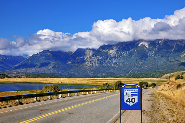
Overview: Ruta Nacional 40, commonly known as Ruta 40, is Argentina’s most legendary road trip—a spine of tarmac and gravel that stretches more than 5,000 kilometers along the eastern flank of the Andes. It runs from the windswept plains of Patagonia in the south to the sun-soaked highlands near Bolivia in the north, passing through some of the country’s most remote, diverse, and awe-inspiring landscapes. Ruta 40 is not just a road; it’s a deep journey into the heart and soul of Argentina, touching on national parks, wine regions, glacial lakes, salt flats, and Andean culture.
The road is a rite of passage for Argentine travelers and an epic adventure for those coming from abroad. It connects not only places, but also moments in time—from pre-Columbian ruins to colonial towns and contemporary gaucho ranches. Whether you drive a section or attempt the entire stretch, Ruta 40 promises isolation, beauty, and discovery on a continental scale.
Distance: Ruta 40 is one of the longest roads in the world, officially stretching about 5,194 kilometers (3,228 miles) from Cabo Vírgenes in Santa Cruz Province in the south to La Quiaca in Jujuy Province at the Bolivian border. It crosses 11 provinces and over 20 national parks, climbing to altitudes above 5,000 meters at its highest point in the Andes.
Route: The southern portion begins in Patagonia, where the road winds through arid plains, towering peaks, and glacial lakes. Towns like El Calafate (home to the Perito Moreno Glacier) and El Chaltén (gateway to Mount Fitz Roy) offer dramatic detours for trekkers and nature lovers. As you move north, Ruta 40 skirts the Andes, running parallel to the Chilean border. The route passes through iconic regions such as the Lakes District near Bariloche, the vineyards of Mendoza, and the red rock valleys of Salta and Jujuy.
Along the way, the road surface varies between paved and gravel, especially in remote southern sections. Each region brings its own character—Patagonia’s wind-swept wilderness, Mendoza’s fertile wine country, and the Andean highlands with their adobe villages and colorful markets. Travelers can approach Ruta 40 in segments or commit to the full cross-country odyssey.
Estimated Time to Complete: Driving the entire length of Ruta 40 takes anywhere from three to six weeks, depending on pace, weather, and how many detours and overnight stops you include. Many travelers opt for a week or two exploring select regions—such as Patagonia, Mendoza, or the northern highlands—rather than covering the full length in one trip. Road conditions, fuel availability, and regional distances can significantly impact travel time.
Things to See on the Way: Ruta 40 offers a constantly shifting landscape of natural wonders and cultural landmarks. In the south, highlights include Los Glaciares National Park, the turquoise Lago Argentino, and the jagged peaks around El Chaltén. In central Argentina, Bariloche offers chocolate shops, alpine architecture, and the Circuito Chico drive. Mendoza invites you to explore Argentina’s famed Malbec vineyards with stunning views of the Andes.
Further north, the Calchaquí Valleys and Quebrada de Humahuaca unfold in brilliant reds, oranges, and ochres. Ancient ruins like Quilmes and Pucará de Tilcara offer windows into pre-Columbian civilizations. Along the way, you’ll encounter fossil fields, salt flats like Salinas Grandes, and remote villages where time feels suspended. Wildlife such as guanacos, condors, and flamingos add to the otherworldly experience, especially in national parks like Talampaya and Parque Nacional Perito Moreno.
Budget: Costs on Ruta 40 vary widely depending on the section, style of travel, and season. Budget travelers using a rented car or campervan, staying in hostels or camping, and cooking meals can expect to spend around $50–$70 USD per day. More comfortable travelers staying in mid-range hotels, dining out, and booking excursions like glacier hikes or wine tours may spend $100–$150 USD per day. Fuel is a significant cost—especially in Patagonia, where distances between towns are vast. Expect higher fuel prices and limited access in remote areas, so planning and extra jerry cans are recommended. Guided tours or private drivers are available in popular segments like Mendoza or Salta but increase costs significantly.
Difficulty: Ruta 40 presents a moderate to high level of difficulty depending on the segment. While much of the road is now paved, large stretches—particularly in the south and high-altitude northern areas—are still gravel or dirt, which can be challenging during rain or snow. In Patagonia, strong crosswinds and isolation require good driving skills and preparation. In the north, altitude can affect both travelers and vehicles, with some sections reaching over 4,500 meters. Weather is unpredictable in all regions, and breakdowns in remote areas can be problematic without a satellite phone or help network.
Driving long hours between sparse towns demands self-sufficiency and endurance. Vehicle maintenance, basic Spanish, and GPS (or offline maps) are important. Experienced drivers will thrive on the freedom and adventure; novice travelers should do thorough research or consider guided options.
Need to Know: Plan fuel stops carefully—there can be up to 300 kilometers between gas stations in Patagonia. Carry cash, as card machines are unreliable in remote areas. Cell coverage is limited outside towns, so downloading offline maps and GPS data is essential. Spare tires, water, and snacks are non-negotiable supplies. Weather can shift quickly, especially in mountainous regions, so always pack layers and prepare for cold nights even in summer.
Some areas require permits to camp or enter indigenous or national park land, especially in the north. Respect for local communities, wildlife, and the fragile environment is essential. Avoid night driving due to animals on the road and lack of lighting. Argentine drivers may be aggressive in urban areas but slower and more cautious on Ruta 40 itself. Emergency services are sparse in remote areas, so drive conservatively and have a backup plan.
Recommended Vehicle: A reliable SUV or 4x4 is ideal for long stretches of Ruta 40, especially in Patagonia and highland gravel sections. While compact cars can handle the fully paved areas, ground clearance and ruggedness are crucial for tackling rough terrain. Many travelers choose to rent campervans or overlanding vehicles to combine transport and lodging. Motorcycle riders frequently take on Ruta 40 in the summer months, though winds and isolation require careful planning and experience. Avoid sedans or low-clearance vehicles for any long-distance travel off pavement.
Top Photo Spot: One of the most iconic photo locations is along the road near El Chaltén, where the peaks of Mount Fitz Roy rise like granite spires from the plains—a truly cinematic scene especially at sunrise. The switchbacks of Cuesta de Miranda in La Rioja provide stunning red rock formations from a bird’s eye perspective. Further north, the multi-colored hills of Purmamarca and the Salinas Grandes salt flats deliver otherworldly photo ops. For a classic Ruta 40 moment, find one of the original road signs against a backdrop of endless road and sky—an image that captures the spirit of the journey like no other.
18.) Trollstigen & Geirangerfjord Route (Norway)
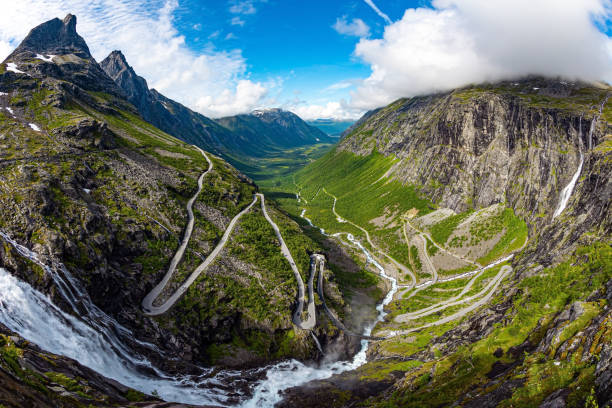
Overview: The Trollstigen and Geirangerfjord Route is one of Norway’s most dramatic and iconic road trips, blending hair-raising mountain switchbacks with ethereal fjord landscapes that seem drawn from myth. Winding through the heart of the Norwegian fjord country, this journey offers a visceral experience of nature’s grandeur, where sheer cliffs, cascading waterfalls, and serpentine roads converge in spectacular harmony. The route combines the legendary Trollstigen mountain road with the UNESCO World Heritage-listed Geirangerfjord, delivering some of the most photogenic and unforgettable scenery in Scandinavia.
This road trip is a celebration of Norway’s engineering feats and its deep relationship with the wild landscape. It showcases the balance between rugged wilderness and human craftsmanship, from carefully carved hairpin turns to impossibly perched viewpoints. Travelers are rewarded with panoramic vistas, charming Nordic villages, and moments of quiet awe as they pass through fjords and mountain passes shaped by ancient glaciers.
Distance: The route connecting Trollstigen and Geirangerfjord is relatively short in distance—roughly 100 to 130 kilometers (62 to 81 miles) depending on the chosen path—but it offers a rich and intense driving experience that can easily fill an entire day or more with stops, photos, and exploration.
Route: The most popular version of this route begins in Åndalsnes, ascending the famous Trollstigen (the “Troll’s Ladder”), a mountain pass with 11 tight switchbacks climbing through the Romsdal Alps. At the top, a modern viewpoint juts out dramatically over the cliffs, offering sweeping views of the valley and the Stigfossen waterfall that cascades beside the road.
From Trollstigen, the route continues over the high plateau, where alpine lakes reflect the sky and snow lingers well into summer. The descent brings travelers toward Valldal, a picturesque valley known for its strawberry farms and riverside cafes. From there, the road winds along the fjords, passing through tunnels and along cliffside routes until it descends into the village of Geiranger at the base of the world-famous Geirangerfjord.
The Geirangerfjord itself is a breathtaking stretch of water flanked by towering cliffs and punctuated by waterfalls like the Seven Sisters and the Suitor. From Geiranger, some travelers choose to continue toward Eidsdal and Linge via ferry, forming a larger loop that connects with the Atlantic Ocean Road or the town of Ålesund.
Estimated Time to Complete: While the actual drive can be completed in three to four hours without stops, most travelers take a full day to truly absorb the beauty of the route. Stopping at viewpoints, hiking trails, waterfalls, and scenic cafes can easily stretch the journey to six or more hours. Staying overnight in Åndalsnes, Valldal, or Geiranger is highly recommended for those looking to explore in depth and avoid rush-hour crowds.
Things to See on the Way: The road itself is a major attraction, particularly Trollstigen with its dizzying curves, elevated lookout platforms, and close encounters with mountain cliffs and waterfalls. At the top, the Trollstigen Visitor Centre blends striking architecture with panoramic views, while short walks take visitors to observation decks perched above the valley.
As the route continues, you’ll pass through lush valleys and alongside shimmering fjords. The Valldal area is known for its fruit farms and local cuisine, and small roadside cafes serve waffles, fresh strawberries, and Norwegian coffee with stunning views. Approaching Geiranger, the Ørnesvingen (Eagle’s Bend) viewpoint provides a breathtaking look over the fjord, especially at sunset.
In Geiranger, boat tours take you closer to the famous waterfalls and abandoned farmsteads clinging to the cliffs. The Fjord Center offers insight into the region’s geology and human history. Adventurous travelers can hike to Skageflå, an old mountain farm offering spectacular views of the fjord from above.
Budget: Norway is one of Europe’s more expensive travel destinations, and this route is no exception. Budget-conscious travelers staying in guesthouses or cabins and self-catering meals can manage on around 1,000 to 1,500 NOK per day (~90 to 130 USD). Mid-range travelers staying in hotels or fjord lodges and dining out may spend 2,000 to 3,000 NOK per day (~180 to 270 USD). Car rentals and fuel are significant costs—especially since steep roads and mountain driving increase fuel consumption. Ferries and parking fees also add to the total cost.
Luxury options such as high-end fjord cruises, fine dining, and premium accommodations with panoramic views can push the daily budget to 4,000 NOK or more (~360 USD). Booking in advance during the summer months is essential, as availability in Geiranger and Trollstigen can be limited.
Difficulty: The route is moderately challenging due to narrow roads, steep gradients, and sharp turns, especially on Trollstigen. Driving requires full attention, particularly during peak tourist months (June to August), when traffic can be heavy and visibility affected by fog or rain. That said, the roads are well-maintained and clearly marked, and with careful driving, most experienced road-trippers will find the route accessible and safe.
Weather can shift rapidly, especially at higher elevations, and snow may linger into late spring. Trollstigen is usually only open from late May to October due to snow closures in winter. The descent into Geiranger includes tight bends and steep drops, so low gears and engine braking are essential. Some travelers with large campervans or trailers may find the route stressful and should check conditions before attempting the full loop.
Need to Know: Check the status of Trollstigen before your trip, as it may close temporarily due to snow, rockslides, or roadwork. The road is closed in winter and early spring. Summer is the best time to visit for clear roads and long daylight hours, but it’s also peak tourist season—start early to avoid crowds. Fuel up in Åndalsnes or Valldal, as stations are sparse along the mountain stretch. Mobile coverage is spotty in certain sections, so download offline maps and bring printed directions as backup.
Wear layers—even in summer, the weather can be cool and damp at higher altitudes. Comfortable shoes are recommended for walking to viewpoints. Parking at major attractions like Trollstigen and Ørnesvingen may be limited, so arrive early or be prepared to wait. Respect speed limits and signage, and yield to buses or larger vehicles on narrow turns. Drone use is regulated, especially in protected areas like Geirangerfjord—check local rules if planning aerial photography.
Recommended Vehicle: A reliable car with good brakes and handling is essential for navigating the tight switchbacks and steep descents. Most standard sedans or hatchbacks are suitable, as long as they’re in good condition. For comfort and peace of mind, a small or mid-size SUV with automatic transmission and hill assist features can be ideal. Motorhomes and campervans are common in summer but may require extra caution and planning on narrower stretches like Trollstigen. Winter driving on this route is not advised, and snow tires or chains are mandatory during the shoulder season.
Top Photo Spot: The top of Trollstigen offers one of Norway’s most iconic views: a panoramic sweep of the road’s dramatic switchbacks with the Stigfossen waterfall plunging down beside it. Another must-capture moment is the view from Ørnesvingen (Eagle’s Bend) overlooking the entire Geirangerfjord, especially when morning mist or golden sunset light drapes the cliffs. For postcard perfection, a boat ride through the fjord offers unbeatable angles of the Seven Sisters and The Suitor waterfalls cascading down sheer cliff faces into deep blue waters.
19.) Mae Hong Son Loop (Thailand)
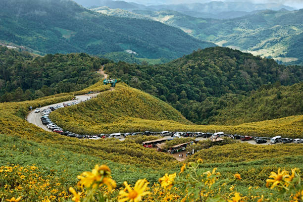
Overview: The Mae Hong Son Loop is one of Southeast Asia’s most thrilling and culturally rich road trips, winding through the mountainous jungles, misty valleys, and hill tribe villages of northern Thailand. Starting and ending in the city of Chiang Mai, this circular route leads travelers deep into the forested province of Mae Hong Son, near the Myanmar border, offering a vivid blend of natural beauty, adventure, and traditional Thai culture. With over 1,800 curves along its roughly 600-kilometer course, the loop has become a rite of passage for motorcyclists and road trippers looking to explore Thailand beyond the typical tourist trail.
This road trip is as much about the experience of the journey as it is about the destinations. From peaceful temples and hot springs to vibrant night markets and quiet mountain towns, the Mae Hong Son Loop offers a window into a side of Thailand that feels both timeless and offbeat. The ever-changing scenery—steep mountain roads, rice terraces, bamboo forests, and scenic viewpoints—makes this loop an exhilarating ride through the heart of northern Thailand’s cultural and geographic diversity.
Distance: The full Mae Hong Son Loop covers approximately 600 to 650 kilometers (373 to 404 miles), depending on detours and stopovers. The classic loop follows a Chiang Mai – Pai – Mae Hong Son – Mae Sariang – Chiang Mai route, forming a full circuit.
Route: The journey typically begins in Chiang Mai, Thailand’s cultural capital, known for its ancient temples and vibrant markets. From there, travelers head northwest to the bohemian mountain town of Pai, a laid-back enclave surrounded by waterfalls, hot springs, and stunning viewpoints like Yun Lai and Pai Canyon.
After Pai, the road ascends into higher mountains, taking drivers through dense jungle and remote hillside terrain toward the town of Mae Hong Son. This area is home to various ethnic groups, including the Shan and Karen people, and features beautiful teakwood temples, like Wat Phra That Doi Kong Mu, which overlooks the town from a hilltop.
The route then turns south toward Mae Sariang, a quieter riverside town surrounded by rice paddies and forested hills. From there, the final leg leads back to Chiang Mai through a more remote stretch of road that winds through mountain passes and rural villages. The loop can be done clockwise or counterclockwise, but most travelers follow the Pai-first direction due to the gradual increase in altitude and better acclimatization.
Estimated Time to Complete: While the Mae Hong Son Loop can technically be completed in three to four days, most travelers prefer to take five to seven days to truly enjoy the route without rushing. Extended stops in Pai, Mae Hong Son, and Mae Sariang offer opportunities to relax, explore local attractions, and engage with the region’s culture and nature.
Things to See on the Way: Each leg of the loop offers a wide array of unique sights and experiences. In Pai, travelers can soak in Tha Pai Hot Springs, visit the Pai Land Split, or hike to a bamboo bridge that crosses scenic farmland. The town itself is known for its lively walking street market and riverside cafes.
Between Pai and Mae Hong Son, the mountainous section of the loop offers viewpoints like Pang Mapha and Soppong, where caves such as Tham Lod can be explored by bamboo raft. Mae Hong Son itself is a cultural highlight, with serene temples, traditional wooden architecture, and lakeside parks like Jong Kham Lake.
On the road to Mae Sariang, you’ll pass through remote tribal villages and have chances to visit hill tribe markets and handicraft cooperatives. Doi Inthanon National Park, Thailand’s highest peak, is a possible detour near the southern part of the loop and offers waterfalls, hiking trails, and cool alpine air.
Budget: The Mae Hong Son Loop is a very affordable road trip, particularly for those traveling by motorbike or public minivan. Budget travelers staying in guesthouses and eating at local markets can complete the loop for around 4,000 to 6,000 THB (~110 to 165 USD) over five to seven days. Mid-range travelers opting for boutique hotels, car rentals, and guided activities may spend 8,000 to 12,000 THB (~220 to 330 USD). Gasoline is inexpensive in Thailand, and food is very affordable.
Luxury accommodations exist in Chiang Mai and Pai but are limited in more remote areas. Even so, a higher-end trip with private guides, upscale hotels, and spa visits can remain under 20,000 THB (~550 USD) for a week-long journey, making it one of the more cost-effective international road trips.
Difficulty: While the Mae Hong Son Loop is not technically difficult in terms of driving conditions, it does require concentration and comfort with winding roads. The loop is famous for its 1,864 curves, many of them tight and blind, especially between Chiang Mai and Pai. Travelers prone to motion sickness should take precautions.
The roads are generally well-paved and in good condition, but some rural sections may have potholes or limited lighting. Driving in the rainy season (June to October) requires caution due to slippery roads and occasional landslides. Road signs are in Thai and English, and most towns have fuel and basic services.
Motorbiking the loop is extremely popular, but safety gear is essential. Helmets, jackets, and gloves should be worn, and riders should avoid night driving and always stay alert for livestock or road debris in rural areas.
Need to Know: A valid international driving permit is required for renting and driving cars or motorbikes in Thailand. Motorbike rental is common in Chiang Mai and Pai, but riders should choose a reliable rental agency and thoroughly inspect vehicles before departure. Insurance coverage varies, so confirm what is included.
Accommodations can usually be found easily without prior booking, except during Thai holidays or high season (November to February). Language barriers are minimal in tourist areas, but rural villages may have limited English speakers. Having a translation app or phrasebook is useful.
Mobile data coverage is good on most parts of the loop, and local SIM cards are inexpensive and widely available. Carry cash, especially for remote towns and roadside stalls, as card payments are less common in rural areas.
Respect local customs, especially when visiting temples or hill tribe communities. Dress modestly, ask before taking photos of people, and support local businesses by buying handicrafts or produce from small vendors.
Recommended Vehicle: The Mae Hong Son Loop is famously done on motorbikes, particularly 110cc–150cc scooters or manual bikes, which are suitable for solo travelers and couples. Experienced riders may opt for larger displacement bikes for comfort on mountain climbs. For those less confident on two wheels, renting a small car or SUV offers more comfort and safety, especially in rainy conditions or with families.
Make sure the vehicle is in good mechanical condition, has good brakes, and comes with spare tools or a repair kit. Flat tires are relatively common on rural roads, but local shops are usually nearby.
Top Photo Spot: One of the most stunning photo locations on the loop is the view from the Yun Lai Viewpoint just outside Pai, where mist blankets the valley at sunrise and the landscape glows with golden morning light. Another favorite is the hilltop Wat Phra That Doi Kong Mu in Mae Hong Son, offering panoramic views of the town and surrounding mountains. For unique cultural shots, the bamboo bridge over rice fields in Ban Rak Thai or the colorful walking streets of Pai at sunset provide memorable visuals of this enchanting region.
20.) Skeleton Coast Drive (Namibia)
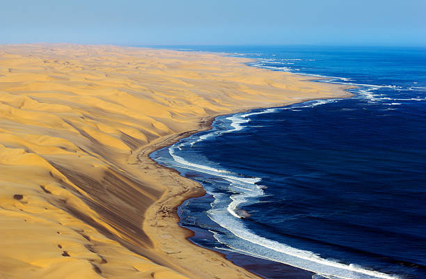
Overview: The Skeleton Coast Drive is one of the most hauntingly beautiful and remote road trips in the world, stretching along Namibia’s northwestern Atlantic coastline through a desolate landscape of shifting dunes, shipwrecks, and fog-shrouded beaches. Named for the whale bones and decaying ships that litter the shoreline, the Skeleton Coast feels like a forgotten edge of the Earth—unforgiving, unpopulated, and starkly stunning.
Traveling this route is less about bustling towns or scenic detours and more about embracing isolation, surreal desert seascapes, and the raw power of nature. It’s an immersive journey through an environment shaped by wind, sand, and sea, where elephants roam the dunes and jackals patrol endless beaches. With its eerie beauty and challenging terrain, the Skeleton Coast offers a road trip experience like no other—a true escape into one of Africa’s last great wildernesses.
Distance: The full Skeleton Coast journey, depending on your starting point and chosen route, spans roughly 500 to 700 kilometers (310 to 435 miles) from Swakopmund or Walvis Bay in the south to the Kunene River mouth at the Angolan border in the north. Most travelers explore the southern and central portions, as access to the far north is strictly controlled and often requires a guided tour or permit.
Route: The drive typically begins in Swakopmund or Walvis Bay, Namibia’s coastal towns known for German colonial architecture and adventure activities. From there, the route heads north along the C34 highway toward the Skeleton Coast National Park. Early on, you pass salt works, vast gravel plains, and the haunting Zeila shipwreck near Henties Bay.
As you enter the park through the Ugab Gate, you’ll drive through a surreal world of blackened lava ridges, salt pans, and giant dunes tumbling into the ocean. Along the way, you’ll see scattered shipwrecks rusting in the sand, weathered whale bones, and the remains of old mining outposts. Key stopping points include the Cape Cross Seal Reserve, home to thousands of noisy Cape fur seals, and the Torra Bay and Terrace Bay camps—two of the only places to stay inside the park.
Farther north, access is typically limited to fly-in safaris or guided overland expeditions into the Skeleton Coast Wilderness Area, where desert-adapted lions, elephants, and hyenas inhabit riverbeds. The route concludes near the Kunene River mouth, a starkly beautiful oasis where desert meets water in a remote, dreamlike setting.
Estimated Time to Complete: A typical self-drive trip along the accessible southern and central sections takes four to five days, starting from Swakopmund and ending at Terrace Bay before turning back. For travelers venturing into the remote northern Skeleton Coast via guided expeditions or fly-in safaris, the journey may extend to seven to ten days. The region is vast and inhospitable, so slow, deliberate travel is essential.
Things to See on the Way: The Zeila and Eduard Bohlen shipwrecks are among the most striking relics of the Skeleton Coast’s maritime history, often half-buried in sand or surrounded by surf. Cape Cross is a must-see, with tens of thousands of fur seals sprawled across the shore, filling the air with noise and the pungent scent of sea life.
Inside Skeleton Coast National Park, the landscape becomes increasingly surreal. Look out for the Clay Castles of the Hoarusib River, a natural fortress of eroded sandstone, and the massive dunes that blend seamlessly into the Atlantic. Further inland, riverbeds like the Hoanib and Hoarusib are vital wildlife corridors, where you may spot giraffes, ostriches, desert lions, and elephants.
The abandoned mining settlements and rusting machinery provide eerie photo opportunities and glimpses into the region’s colonial and industrial past. Desert sunsets are unforgettable, casting the sands and ocean in golden light as jackals prowl the shorelines.
Budget: A self-drive trip to the Skeleton Coast can be done on a mid- to high-range budget. A 4x4 rental is essential, costing between 60 to 120 USD per day, with additional expenses for fuel, park entry fees, and permits. Basic camping or accommodations in places like Terrace Bay and Torra Bay are affordable but limited, with lodges in and around Swakopmund and Damaraland offering more upscale options.
Expect to spend between 800 to 1,500 USD for a five-day self-drive trip, including rental, permits, and lodging. Guided luxury safaris that access the restricted northern regions can cost significantly more—between 3,000 and 6,000 USD per person for multi-day fly-in packages, including all meals, transfers, and game drives.
Difficulty: This is a challenging and remote road trip best suited to experienced overland travelers. The terrain ranges from rough salt roads and gravel plains to sandy tracks and dry riverbeds. Navigation can be difficult, and breakdowns or fuel shortages can become serious problems due to the extreme isolation.
The Skeleton Coast is also notorious for sudden fog banks, strong coastal winds, and extreme temperatures. Travelers must be self-reliant, carrying extra fuel, food, water, and recovery gear. Cell service is nonexistent in much of the park, and weather conditions can change rapidly. Travel in convoy or with a satellite phone is strongly recommended for safety.
Need to Know: Travelers must obtain permits to enter Skeleton Coast National Park, which can be arranged through Namibia Wildlife Resorts or the Ministry of Environment, Forestry and Tourism. Entry is only allowed during daylight hours, and camping is restricted to designated areas. Fuel is limited north of Henties Bay, so refueling before entering the park is essential.
4x4 vehicles are required for large sections, particularly if you plan to leave the main gravel roads. Sand driving experience is helpful, and tire pressure should be reduced on dune stretches. Pack a full first-aid kit, spare tires, and extra food and water in case of emergencies.
Respect the fragile desert ecosystem—disturbing wrecks, wildlife, or archaeological sites is prohibited. The Skeleton Coast’s allure lies in its rawness, so travelers must be prepared to tread lightly and self-sufficiently through this otherworldly region.
Recommended Vehicle: A high-clearance 4x4 with off-road tires is essential for tackling the Skeleton Coast. Toyota Hilux and Land Cruiser models are popular choices among overlanders due to their durability and ease of repair. Roof tents and onboard fridges can enhance comfort, while recovery gear, extra fuel, and spare parts are non-negotiable for long hauls. Standard sedans and compact SUVs are not suitable for this journey.
Top Photo Spot: One of the most iconic photo moments is at the Eduard Bohlen shipwreck, lying eerily stranded in the desert over 400 meters from the sea due to shifting sands. Another stunning visual is the view from atop a dune at sunrise near Terrace Bay, where the desert glows orange against the endless Atlantic surf. The seal colony at Cape Cross, with its thousands of sea mammals dotting the beach, offers unforgettable wildlife photography in a surreal coastal setting.
21.) Blue Ridge Parkway (USA, Virginia to North Carolina)
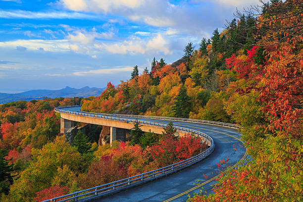
Overview: The Blue Ridge Parkway is one of America’s most iconic scenic drives, winding through the heart of the Appalachian Mountains from Virginia to North Carolina. Known as “America’s Favorite Drive,” this 755-kilometer (469-mile) route offers a serene, uninterrupted passage through misty mountain ranges, lush forests, and vibrant cultural heritage. It connects Shenandoah National Park in Virginia with Great Smoky Mountains National Park in North Carolina, serving as both a transportation corridor and a gateway to some of the most spectacular natural beauty in the eastern United States.
This road trip is as much about the journey as the destination—no billboards, no commercial traffic, and no fast food chains, just a two-lane ribbon of road carefully integrated into the surrounding landscape. Whether it’s spring wildflowers, summer greenery, fiery autumn foliage, or the quiet magic of winter frost, the Blue Ridge Parkway invites a slower pace and a deeper connection with nature, history, and Appalachian culture.
Distance: The Blue Ridge Parkway stretches approximately 755 kilometers (469 miles) from Rockfish Gap in Virginia to Cherokee, North Carolina. Although not a long drive by distance alone, its winding curves, numerous overlooks, and lower speed limits make for a leisurely and immersive experience.
Route: The route begins at the southern end of Virginia’s Shenandoah National Park, where the Skyline Drive meets the Parkway at Rockfish Gap. From there, it meanders through the Blue Ridge Mountains, offering countless pull-offs with panoramic vistas of valleys, ridges, and distant peaks. The parkway passes near charming mountain towns like Roanoke, Blowing Rock, and Little Switzerland, each offering unique cultural and culinary stops.
As the drive continues south into North Carolina, travelers pass through Pisgah National Forest and cross into higher elevations near Mount Mitchell, the tallest peak east of the Mississippi River. The Parkway ends at the Oconaluftee Visitor Center in Cherokee, just inside the entrance to Great Smoky Mountains National Park. The entire route is free of commercial development, offering uninterrupted scenic driving and access to hundreds of hiking trails, waterfalls, and historical sites.
Estimated Time to Complete: Most travelers take between five to seven days to complete the full length of the Blue Ridge Parkway, stopping frequently at overlooks, visitor centers, and towns along the way. While it’s possible to drive it in two to three days, a slower pace is highly recommended to appreciate the natural beauty, walking trails, and cultural attractions.
Things to See on the Way: Highlights along the Blue Ridge Parkway are numerous and diverse. In Virginia, Humpback Rocks offers a short hike to sweeping views, and Mabry Mill is a beloved photo stop featuring a picturesque historic gristmill. The Peaks of Otter provide hiking opportunities and a serene lakefront lodge.
In North Carolina, the Linn Cove Viaduct near Grandfather Mountain is an engineering marvel that hugs the cliffs with dramatic views. The Folk Art Center near Asheville showcases regional crafts and Appalachian artistry. Mount Mitchell State Park invites a detour to the summit of the highest peak in eastern North America.
Wildlife sightings include black bears, wild turkeys, white-tailed deer, and hundreds of bird species. Fall is especially spectacular, when the forests explode in shades of red, orange, and gold, drawing “leaf peepers” from all over the country.
Budget: The Blue Ridge Parkway is a budget-friendly road trip, as there are no tolls or entrance fees along the route. Costs largely depend on accommodations, dining, and optional activities. Budget travelers camping or staying in roadside motels might spend 500 to 800 USD for a week-long trip. Mid-range travelers using bed and breakfasts or cabin rentals can expect to spend around 1,000 to 1,500 USD. Those opting for boutique inns, gourmet dining, and private tours could budget upwards of 2,000 USD for a more luxurious experience.
Food and lodging options are plentiful in nearby towns, but limited directly on the Parkway, so advance planning is helpful, especially in peak fall foliage season.
Difficulty: The Blue Ridge Parkway is one of the most accessible and beginner-friendly road trips in the United States. The road is well-maintained with clear signage, though it does feature numerous curves, elevation changes, and occasional fog. Speed limits are low (typically 45 mph or less), and commercial traffic is prohibited, making the drive peaceful and safe.
Drivers should be cautious during early morning or evening hours when wildlife is more active and visibility can be reduced. In winter, certain sections may be closed due to snow or ice, particularly in the higher elevations of North Carolina. Weather can vary dramatically along the route, so packing for changing conditions is essential.
Need to Know: Cell service can be spotty on the Parkway, especially in more remote areas. Download offline maps and guides before starting the drive. Gas stations are not located directly on the Parkway, so it’s wise to fill up in nearby towns before long stretches. Visitor centers along the route provide maps, ranger advice, and historical information.
Reservations for lodging, especially in national park lodges or mountain cabins, are recommended during peak seasons like summer and autumn. A printed guidebook or audio tour can greatly enhance the experience by pointing out historical sites, hiking trails, and hidden gems along the way.
Motorcyclists, cyclists, and RV travelers also frequent the Parkway, so respectful driving and extra caution around curves are important. Leave-no-trace principles apply at picnic spots and trails to help preserve the beauty of the landscape.
Recommended Vehicle: Any standard car can comfortably drive the Blue Ridge Parkway, making it suitable for families, couples, or solo travelers. Convertibles or cars with sunroofs are ideal for enjoying the crisp mountain air and unobstructed views. Motorcycles are also popular, though riders should prepare for unpredictable weather and strong crosswinds at elevation. RVs are allowed but should be aware of size restrictions in tunnels and the narrow, winding nature of certain sections.
Top Photo Spot: One of the most iconic photo spots is the Linn Cove Viaduct near Grandfather Mountain, where the curving road appears to float above the forested mountainside. Another breathtaking viewpoint is Craggy Gardens just north of Asheville, especially at sunrise when clouds roll through the peaks. In autumn, the overlook at Rough Ridge provides sweeping views of flame-colored trees spilling down into the valleys below, perfect for capturing the Parkway’s fall magic.
22.) Balkan Peninsula Road Trip (Slovenia to Montenegro)
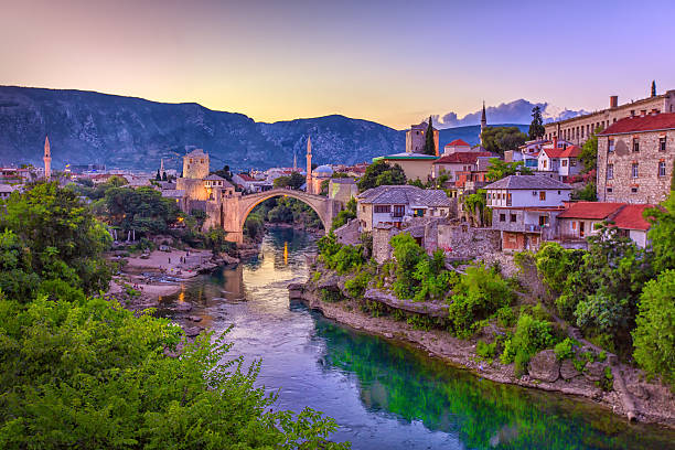
Overview: The Balkan Peninsula Road Trip from Slovenia to Montenegro is a breathtaking journey through some of Europe’s most underrated and diverse landscapes. Spanning alpine peaks, Adriatic coastlines, medieval towns, and rugged mountains, this cross-country drive reveals the cultural richness and historical complexity of the Western Balkans. It offers a unique blend of Central European charm, Mediterranean flair, and Balkan mystique, passing through Slovenia, Croatia, Bosnia and Herzegovina, and Montenegro.
Travelers experience everything from the emerald lakes and highland forests of Slovenia to the sun-soaked Dalmatian coast and the ancient walled cities of the Adriatic. Along the way, you’ll encounter Ottoman-era bridges, Austro-Hungarian architecture, Roman ruins, and Orthodox monasteries—making this road trip not only scenic, but deeply cultural and historical. It’s a journey of discovery through a region that has endured conflict, celebrated resilience, and now thrives as one of Europe’s emerging travel gems.
Distance: The route from Ljubljana, Slovenia to Kotor, Montenegro spans roughly 800 to 1,000 kilometers (500 to 620 miles), depending on the path and detours taken. The relatively short distances between major highlights allow for flexible pacing and plenty of time for exploration.
Route: Starting in Slovenia’s capital Ljubljana, the road heads south to the picturesque Lake Bled and Lake Bohinj, before crossing into Croatia via the scenic Karst region. From there, it follows the Adriatic coast through charming cities like Rijeka, Zadar, and Split, with optional inland detours to the Plitvice Lakes National Park and Krka waterfalls.
Entering Bosnia and Herzegovina, the route heads to Mostar, famous for its rebuilt Ottoman bridge and blend of cultures. Continuing south, travelers re-enter Croatia briefly at Dubrovnik—a UNESCO World Heritage Site known for its ancient city walls—before reaching the fjord-like Bay of Kotor in Montenegro, where steep mountains plunge into the Adriatic Sea. The road then winds around the bay to medieval Kotor and the mountain town of Cetinje, with an option to continue to Lovćen National Park or the stunning Adriatic beaches near Budva.
Estimated Time to Complete: A typical Balkan Peninsula road trip takes 7 to 14 days, depending on how many stops you make and the pace of travel. A slower, more immersive pace is ideal, with at least two days each in Slovenia, Croatia’s coast, Bosnia and Herzegovina, and Montenegro. Shorter versions can be done in 5–7 days if focused on fewer highlights.
Things to See on the Way: Lake Bled in Slovenia is an essential stop, with its fairy-tale island church and cliffside castle. Nearby Lake Bohinj offers a quieter, more alpine experience. Croatia’s Plitvice Lakes National Park is a UNESCO-listed marvel of cascading waterfalls and turquoise lakes. The Dalmatian cities of Split and Dubrovnik offer ancient Roman ruins, walled towns, and Adriatic views.
In Bosnia and Herzegovina, Mostar’s Stari Most bridge and Ottoman bazaar are cultural icons. The route may also include stops in Sarajevo for its poignant mix of East and West, or the Dervish monastery at Blagaj built into a cliff. Montenegro’s Bay of Kotor, a UNESCO World Heritage Site, features fjord-like beauty and historic towns like Perast and Kotor. For panoramic views, the serpentine road up to Lovćen National Park rewards travelers with unforgettable vistas of the Adriatic coastline.
Budget: This road trip can accommodate a wide range of budgets. Budget travelers using hostels, basic guesthouses, and self-catering can complete the journey for as little as 600 to 900 EUR per person for 10–14 days. Mid-range travelers staying in boutique hotels and dining out moderately should plan for 1,200 to 1,800 EUR. Luxury travelers choosing high-end accommodations, fine dining, and private tours could spend upwards of 2,500 to 3,500 EUR.
Fuel and toll costs are moderate, especially compared to Western Europe, though border crossings may require vignette purchases or insurance. Food and lodging are generally affordable in Bosnia and Herzegovina and Montenegro, slightly higher in Croatia and Slovenia.
Difficulty: This is a relatively easy road trip in terms of driving difficulty. Roads are generally well-paved and signposted, though mountain routes in Montenegro and Bosnia can be narrow and winding. Drivers must be prepared for frequent border crossings and should check visa or entry requirements if using a non-EU passport. Traffic can be heavy near coastal cities in summer, particularly in Croatia and around Lake Bled.
Local driving customs can vary, so defensive driving and awareness are important, especially in rural or mountainous areas. Navigation apps are helpful, but downloading offline maps is recommended due to intermittent service in remote regions. Parking in historic centers can be limited, so park-and-walk options are often better.
Need to Know: Travelers should carry passports at all times for border crossings and check whether a “green card” insurance document is required for driving into Bosnia and Herzegovina or Montenegro. Currency differs between countries: Slovenia uses the euro, Croatia now uses the euro as well, but Bosnia and Herzegovina uses the convertible mark (BAM), and Montenegro also uses the euro unofficially.
It’s wise to bring some cash for tolls and rural purchases, as card machines are not always reliable in remote areas. Language barriers are minimal in tourist areas, but English is less common in rural towns—having a translation app or phrasebook helps. Always respect local customs and be mindful of recent histories, especially in Bosnia and Herzegovina, where war memories are still fresh.
Recommended Vehicle: A compact or mid-size car is ideal for navigating narrow streets and mountain roads, with enough power for hill climbs and space for luggage. Automatic transmissions are available but less common, so manual driving experience may be useful. If traveling in winter or through mountainous terrain, a vehicle with strong brakes and good tires is essential. Car rentals are widely available in Ljubljana, with one-way drop-offs often possible in Montenegro for an extra fee.
Top Photo Spot: One of the most dramatic photo spots is the viewpoint over the Bay of Kotor from the Lovćen serpentine road, where switchbacks reveal the entire bay glittering below. Another iconic shot is of Mostar’s Stari Most bridge, especially at sunset when the stone glows golden. Lake Bled’s island church seen from Ojstrica viewpoint is another postcard-perfect image. Along the Croatian coast, sunset shots of Dubrovnik’s old city walls and red roofs against the Adriatic are some of the most memorable in Europe.
23.) Silk Road (Modern Route) (China to Turkey)
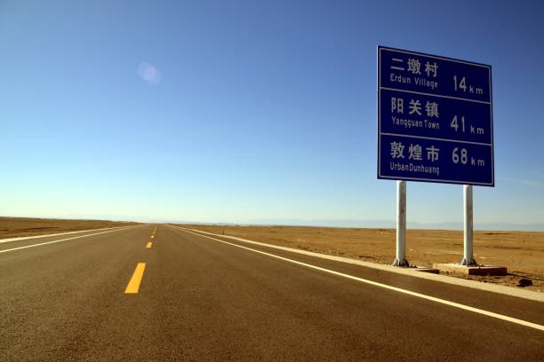
Overview: The Silk Road is one of history’s most legendary trade routes, linking East and West for centuries and shaping cultures, commerce, and civilizations. The modern Silk Road road trip follows this ancient pathway from China’s vast deserts and oases through Central Asia’s mountain passes and steppe plains, finally reaching the historic cities of Turkey. This journey is a grand adventure across diverse landscapes and vibrant cultures—combining ancient ruins, bustling bazaars, and breathtaking natural wonders.
Travelers experience the convergence of Chinese, Persian, Turkic, and European influences, traversing Silk Road cities like Xi’an, Kashgar, Samarkand, Bukhara, and Istanbul. The route offers an unparalleled opportunity to explore the cradle of the Silk Road’s storied past while witnessing how modern nations connect across this legendary corridor. This epic drive is an immersive blend of history, culture, and spectacular geography.
Distance: The modern Silk Road route stretches approximately 9,000 kilometers (5,600 miles) from Xi’an, China to Istanbul, Turkey, crossing multiple countries including China, Kyrgyzstan, Uzbekistan, Turkmenistan, Iran, and Turkey. Distances between major cities vary widely, making flexible travel plans essential.
Route: Starting in Xi’an, the ancient eastern terminus of the Silk Road, the journey heads west through China’s arid deserts and Uyghur regions to Kashgar, a vibrant hub near the Kyrgyz border. Crossing into Kyrgyzstan, the route traverses mountainous terrain via the scenic Torugart Pass into Uzbekistan.
In Uzbekistan, the road links the historic cities of Samarkand, Bukhara, and Khiva, famed for their stunning Islamic architecture and centuries-old madrasahs and bazaars. From Uzbekistan, travelers often detour through Turkmenistan’s Karakum Desert before entering Iran, where the route winds through cities like Mashhad and Tehran, combining ancient Persian heritage with bustling modern life.
Crossing into Turkey, the Silk Road culminates in Istanbul, a city bridging Asia and Europe, where Byzantine and Ottoman history meets a dynamic contemporary culture. Modern highways trace much of this route, but sections remain challenging and adventurous, especially in mountainous and desert regions.
Estimated Time to Complete: Completing the Silk Road in its entirety is a major undertaking, typically requiring at least 4 to 6 weeks depending on border crossings, visa requirements, and time spent exploring historic sites. Travelers often break the trip into segments or focus on highlights due to the vast distances and complex logistics.
Things to See on the Way: Xi’an’s Terracotta Warriors are a must-see, showcasing China’s imperial past. Kashgar’s Sunday market offers a lively taste of Central Asian culture and trade. Uzbekistan’s cities boast stunning landmarks such as Registan Square in Samarkand and the Ark Fortress in Bukhara.
The Karakum Desert in Turkmenistan reveals surreal landscapes and the famous Darvaza Gas Crater, known as the “Door to Hell.” In Iran, the intricate tilework of Isfahan’s mosques and the bazaars of Tehran reflect a rich Persian legacy.
Finally, Istanbul’s Hagia Sophia, Topkapi Palace, and the Bosphorus Strait encapsulate centuries of East-West cultural fusion. Along the way, the road passes through breathtaking mountains, vast deserts, and fertile valleys, offering a panorama of nature’s extremes.
Budget: Traveling the Silk Road is moderately costly, influenced by visa fees, permits, vehicle rental or purchase, fuel, accommodation, and dining. Budget travelers using shared transportation and guesthouses may manage with 1,500 to 2,500 USD for a month-long segment.
Mid-range travelers opting for rental cars or guided tours and staying in mid-level hotels should budget 3,000 to 5,000 USD for several weeks. Luxury travel with private drivers, boutique hotels, and personalized services can easily exceed 7,000 USD.
Fuel is generally affordable, but border fees, insurance, and occasional bribes or unofficial charges may increase costs. Planning and local knowledge are key to managing expenses.
Difficulty: The Silk Road journey is challenging due to long distances, variable road conditions, and complex border crossings requiring multiple visas and permits. Language barriers and regional political sensitivities add complexity. Some sections, especially in Central Asian mountains and deserts, may be rough or isolated.
Travelers should be experienced drivers or hire local guides familiar with regional conditions. Safety varies by country, so staying informed about travel advisories and local regulations is critical. Navigation requires reliable GPS and offline maps, as cell service can be inconsistent.
Need to Know: Visas and permits are essential and often the biggest logistical hurdle. Many countries along the Silk Road require advance visa applications and vehicle import permits. Check all requirements carefully before departure.
Currency changes frequently; cash is often necessary as card acceptance is limited in remote areas. Health precautions include vaccinations, carrying medical kits, and preparing for variable water quality.
Border crossings can be time-consuming and bureaucratic. Flexibility in timing and patience are necessary. Travel insurance covering medical evacuation and vehicle assistance is highly recommended.
Respect for local customs, religions, and sensitivities is vital in this culturally diverse region. Learning basic phrases in local languages and engaging respectfully with communities enhances the experience.
Recommended Vehicle: A rugged, reliable 4x4 vehicle is strongly recommended due to variable terrain including mountain passes, desert tracks, and poor rural roads. Vehicles with high ground clearance, extra fuel capacity, and good cooling systems are best. Many travelers opt for SUVs, Land Cruisers, or specially outfitted expedition vehicles.
Proper vehicle maintenance and carrying spare parts and tools are essential, as repair facilities can be scarce in remote areas. Some sections require permits for certain vehicle types.
Top Photo Spot: Iconic photo opportunities abound along the Silk Road. The towering sandstone cliffs and ancient city walls of Khiva create a fairy-tale backdrop. Samarkand’s Registan Square at sunset, with its intricate tilework glowing in warm light, is unforgettable.
The surreal, fiery glow of the Darvaza Gas Crater in Turkmenistan offers a dramatic night shot. Finally, Istanbul’s silhouette at dusk, with the domes and minarets of Hagia Sophia framed against the Bosphorus, captures the enduring spirit of the Silk Road’s crossroads of civilizations.
24.) New Zealand’s South Island Circuit
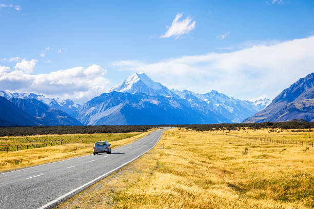
Overview: New Zealand’s South Island Circuit is a spectacular journey through some of the world’s most diverse and pristine natural landscapes. Renowned for its dramatic fjords, soaring alpine peaks, glaciers, turquoise lakes, and rugged coastlines, the South Island offers an outdoor lover’s paradise. This circuit takes travelers on a full loop around the island, connecting vibrant towns, adventure hotspots, and remote wilderness areas, blending thrilling activities with breathtaking scenery.
From the vibrant city of Christchurch to the adventure capital Queenstown, and the tranquil beauty of the Marlborough Sounds to the towering Southern Alps and Fiordland National Park, this route showcases why New Zealand is a bucket-list destination for nature and adventure seekers. The South Island Circuit is not just a drive but a multi-day exploration packed with hiking, kayaking, wildlife spotting, and cultural experiences.
Distance: The full circuit covers approximately 1,500 to 1,700 kilometers (930 to 1,060 miles), depending on detours and side trips. This makes for a comfortable journey with plenty of stops to explore.
Route: Starting in Christchurch on the east coast, the route heads south to Lake Tekapo and Mount Cook National Park, where the Southern Alps rise dramatically. Continuing southwest, the road reaches the adventure hub of Queenstown, nestled on the shores of Lake Wakatipu.
From Queenstown, travelers drive west toward the fjords, stopping at Te Anau before entering Fiordland National Park to experience Milford Sound or Doubtful Sound by boat or kayak. Heading north along the west coast, the journey includes stops at the Franz Josef and Fox Glaciers, surrounded by lush rainforest.
The route then turns east over the Haast Pass to Wanaka, a laid-back lakeside town with stunning mountain views. From Wanaka, the road heads northeast to the wine region of Marlborough via the alpine town of Nelson, known for its arts scene and beautiful coastline.
The final leg leads back down the east coast through Kaikōura, famous for whale watching, before returning to Christchurch, completing the circuit.
Estimated Time to Complete: Travelers typically allocate 10 to 14 days for the full South Island Circuit, allowing time for hiking, adventure activities, and relaxation. A faster pace is possible in a week, but this risks missing many highlights.
Things to See on the Way: Lake Tekapo’s turquoise waters and the Church of the Good Shepherd are iconic photo stops. Mount Cook National Park offers some of New Zealand’s best alpine hikes. Queenstown delivers adrenaline-pumping activities like bungee jumping, jet boating, and skydiving.
Milford Sound’s fjords are among the most stunning natural features on earth, best explored by cruise or kayak. The Franz Josef and Fox Glaciers provide rare access to ancient ice flows surrounded by temperate rainforest.
Wanaka’s lakeside trails and Nelson’s sunny beaches and galleries showcase a quieter side of the island. Kaikōura’s marine wildlife, including sperm whales and dolphins, offers unforgettable encounters.
Budget: The South Island Circuit can fit a range of budgets. Budget travelers camping or staying in hostels can complete the trip for approximately 1,200 to 1,800 NZD (750 to 1,150 USD) over two weeks. Mid-range travelers staying in motels or holiday parks and enjoying some guided tours might budget 2,500 to 4,000 NZD (1,600 to 2,600 USD). Luxury options with boutique lodges, private tours, and fine dining can exceed 6,000 NZD (3,900 USD).
Fuel, park entry fees, and adventure activities are the main variable costs.
Difficulty: The roads around the South Island are generally well-maintained and suitable for all driver levels. Mountain passes like Arthur’s Pass and Haast Pass require careful driving but are manageable with normal precautions. Weather can change quickly, especially in alpine areas, so preparedness is important.
Some gravel roads and narrow stretches exist but are short and well-marked. Renting a standard vehicle is typically sufficient, but some adventure seekers opt for campervans for flexibility.
Need to Know: New Zealand drives on the left-hand side. International drivers should carry a valid license and consider obtaining an International Driving Permit.
Weather can be highly variable, especially in spring and autumn, so layering and waterproof clothing are essential. Booking popular activities and accommodations in advance, especially in peak season (December to February), is highly recommended.
Wi-Fi and cell coverage are good in towns but patchy in remote areas. Fuel stations can be sparse in some regions, so refuel when possible.
Respect for Maori culture and local conservation rules is important. Leave no trace principles are strongly encouraged throughout the national parks.
Recommended Vehicle: A reliable compact or mid-size car is ideal for this route, with sufficient luggage space and good fuel efficiency. Campervans are popular for travelers wanting accommodation and transport combined. Four-wheel-drive vehicles are not essential unless planning off-road excursions.
Top Photo Spot: The viewpoint over Lake Tekapo with the church framed by mountains is a classic shot. Milford Sound’s sheer cliffs rising from the fjord create stunning panoramas, especially in morning mist. Queenstown’s skyline with Lake Wakatipu and The Remarkables mountain range is iconic, while the glacier views at Franz Josef offer dramatic icy landscapes. Sunset at Kaikōura with whales breaching offshore is another unforgettable scene.
25.) Tibet to Nepal Overland (Friendship Highway)
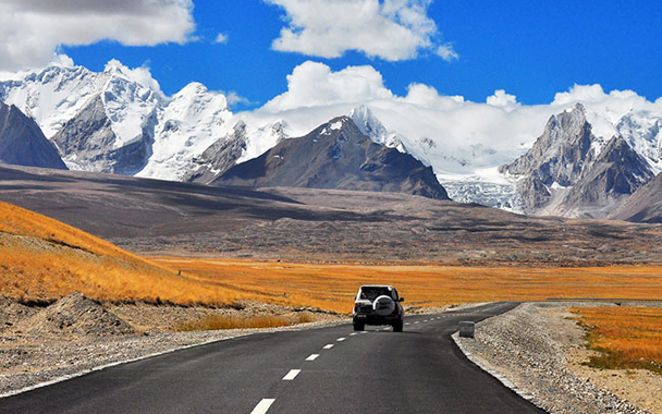
Overview: The Tibet to Nepal Overland route, known as the Friendship Highway, is an extraordinary journey through the heart of the Himalayas, linking the Tibetan capital Lhasa with Kathmandu, Nepal’s vibrant and historic capital. This route follows one of the highest and most dramatic highways in the world, offering travelers a deep dive into Tibetan culture, stunning mountain landscapes, and the unique blend of Buddhism and Himalayan traditions.
Traveling the Friendship Highway is as much a spiritual and cultural expedition as a road trip. Along the way, you cross some of the highest motorable passes on earth, pass vast Tibetan plateaus and pristine lakes, and enter remote villages that have remained largely unchanged for centuries. The route culminates with a descent into the lush Kathmandu Valley, contrasting sharply with the high-altitude Tibetan steppe.
Distance: The Friendship Highway covers approximately 800 kilometers (500 miles) from Lhasa to Kathmandu. While not a long distance by modern standards, the high altitude and winding mountain roads make it a challenging and unforgettable drive.
Route: The journey begins in Lhasa, home to the Potala Palace and Jokhang Temple, central to Tibetan Buddhism. Heading southwest, the road climbs steadily over high passes such as the Gyatso La Pass (over 5,200 meters / 17,000 feet), offering panoramic views of snow-capped peaks and glaciers.
The highway skirts sacred lakes such as Yamdrok and Namtso, shimmering turquoise against the stark Tibetan plateau. Travelers pass through quaint towns like Shigatse, Tibet’s second-largest city, and near Mount Everest’s northern base camp at Rongbuk Monastery.
Crossing into Nepal, the road descends rapidly through lush, forested valleys, ending in Kathmandu with its historic Durbar Square, lively markets, and a rich fusion of Hindu and Buddhist cultures.
Estimated Time to Complete: Most travelers take between 5 to 7 days to complete the Friendship Highway trip, allowing time for acclimatization, sightseeing, and the slow pace required by mountain driving. It’s common to stop overnight in Lhasa, Shigatse, and near Everest Base Camp before continuing to Nepal.
Things to See on the Way: Lhasa’s Potala Palace and Jokhang Temple provide a majestic introduction to Tibetan culture. The turquoise Yamdrok Lake is one of Tibet’s most beautiful natural landmarks, framed by snow-capped peaks.
Shigatse hosts the impressive Tashilhunpo Monastery, seat of the Panchen Lama. Near Mount Everest’s north side, the Rongbuk Monastery and Base Camp offer breathtaking mountain vistas. The Nepalese side brings a lush landscape with terraced fields, traditional villages, and the ancient temples and stupas of Kathmandu.
The route also offers numerous opportunities to witness Tibetan nomadic life, Buddhist festivals, and Himalayan wildlife like the elusive snow leopard in protected reserves.
Budget: Traveling the Friendship Highway tends to be a mid- to high-budget endeavor, mainly due to permits, guided tours, vehicle rental, accommodation, and food in remote areas. Independent travel is restricted, so many rely on organized tours.
Expect to spend around 1,500 to 3,000 USD for a week-long trip with mid-range accommodations and a guide. Budget travelers may find options with simpler guesthouses and group tours closer to 1,200 USD. Luxury options with private vehicles and upscale lodging are available at higher prices.
Difficulty: This is a demanding road trip requiring acclimatization to extreme altitude, careful driving on narrow and sometimes rough mountain roads, and preparedness for sudden weather changes. The route is open mainly from late spring to early autumn, as winter snow can close passes.
Drivers should be experienced and aware of altitude sickness symptoms. The political sensitivity of the Tibet region means travelers must have appropriate permits and travel under guided supervision.
Need to Know: Travel in Tibet requires official permits and must be part of an organized tour or with authorized guides. Independent travel is not generally allowed. Border crossings between Tibet and Nepal are tightly controlled, with customs and immigration procedures requiring careful preparation.
Altitude sickness is a serious risk; acclimatization days and medication are recommended. Carry warm clothing, sufficient food and water, and basic medical supplies. Communication is limited in remote areas, so plan accordingly.
Respect for Tibetan culture and customs is essential, as well as environmental responsibility to preserve this fragile region.
Recommended Vehicle: A sturdy four-wheel-drive vehicle with high clearance is essential for this route, given steep gradients, narrow mountain roads, and occasional rough patches. Many tours use Toyota Land Cruisers or similar SUVs suited to the high-altitude terrain.
Vehicles should be well-maintained with spare parts and supplies, as repair facilities are limited. Drivers should be skilled in mountain driving and prepared for challenging conditions.
Top Photo Spot: Some of the most iconic images come from the Gyatso La Pass, where panoramic views stretch across Himalayan peaks and turquoise lakes. Yamdrok Lake offers stunning reflections and dramatic contrasts between water and mountains.
The Rongbuk Monastery with Everest’s towering north face in the background is a once-in-a-lifetime photo opportunity. Finally, Kathmandu’s ancient temples and bustling streets provide vibrant urban and cultural scenes to close the journey.
26.) Atacama Desert to Salar de Uyuni Crossing (Chile to Bolivia)
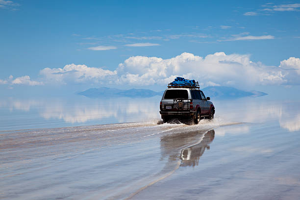
Overview: The road trip from Chile’s Atacama Desert to Bolivia’s Salar de Uyuni Crossing is an epic journey through some of the most otherworldly landscapes on Earth. Starting in the driest desert in the world, the route traverses vast salt flats, high-altitude volcanoes, colorful lagoons, and remote Andean villages. This adventure blends extreme geography with vibrant indigenous culture and surreal natural wonders, making it a must-do for travelers seeking unique South American experiences.
This journey is not only a road trip but a multi-day expedition into the heart of the Altiplano plateau, where high desert meets giant salt deserts and towering mountains. Crossing from Chile into Bolivia, travelers witness spectacular volcanic landscapes, flamingo-filled lagoons, and the iconic white salt crust of the world’s largest salt flat.
Distance: The distance from San Pedro de Atacama in northern Chile to the town of Uyuni in Bolivia is approximately 520 kilometers (320 miles). The route involves rough and varied terrain, including gravel roads, salt flats, and high mountain passes.
Route: Starting in San Pedro de Atacama, the trip heads northeast, crossing the Chilean Altiplano. Key stops include the El Tatio Geysers and the vivid Valle de la Luna (Moon Valley). The route climbs to high altitude as it approaches the border at Hito Cajon.
After crossing into Bolivia, travelers enter Eduardo Avaroa Andean Fauna National Reserve, a highlight of the journey, featuring surreal landscapes such as the red-hued Laguna Colorada, the greenish Laguna Verde, and numerous flamingo colonies. The area also hosts volcanic peaks, geysers, and hot springs.
The route culminates with the crossing of the Salar de Uyuni, the world’s largest salt flat, a vast white desert that reflects the sky in the rainy season and creates a surreal, mirror-like surface. The journey ends in the town of Uyuni, gateway to further Bolivian adventures.
Estimated Time to Complete: Due to the challenging terrain and high altitude, travelers typically take between three to five days to complete this crossing. Guided tours often spread the route over four days, allowing time for acclimatization, sightseeing, and rest.
Things to See on the Way: The El Tatio Geysers are one of the highest geothermal fields in the world, best visited at sunrise when steam columns create an eerie atmosphere. Valle de la Luna offers lunar-like rock formations and salt crusts.
On the Bolivian side, the Eduardo Avaroa Reserve is famous for its vibrant lagoons teeming with flamingos, such as Laguna Colorada, which is painted red by algae. The hot springs at Polques provide a warm respite amid the cold high desert.
Salar de Uyuni is the highlight, with endless white salt plains perfect for striking photographs and visits to Incahuasi Island, a cactus-covered outcrop in the salt desert.
Budget: Traveling this route is often done via guided tours, with budget options around 200 to 400 USD for 3 to 4 days. Mid-range tours with better vehicles, meals, and accommodations range from 400 to 700 USD. Private and luxury tours with customized itineraries and higher-end lodging can exceed 1,000 USD.
Costs include permits, park entry fees, vehicle rental or tour costs, food, and lodging in basic desert refuges or mountain hostels.
Difficulty: This road trip requires good physical fitness and acclimatization due to altitudes often exceeding 4,000 meters (13,000 feet). The roads are rough, frequently unpaved, and may be affected by weather, including sudden storms.
Travelers should be prepared for cold nights, intense sun during the day, and limited facilities. Driving independently is possible but not recommended without experience on high-altitude off-road conditions. Most travelers join organized 4x4 tours.
Drivers should be experienced and aware of altitude sickness symptoms. The political sensitivity of the Tibet region means travelers must have appropriate permits and travel under guided supervision.
Need to Know: Altitude sickness is a significant risk—allow time for acclimatization in San Pedro or nearby towns before starting the crossing. Bring warm clothing, sun protection, plenty of water, and basic medical supplies.
Border crossing formalities require valid passports and visas if applicable. Bolivia requires a vehicle import permit if driving independently.
Mobile phone coverage is limited; rely on guides and plan accordingly. Respect local indigenous communities and fragile environments.
Recommended Vehicle: A 4x4 vehicle with high clearance is essential due to rough terrain, salt crusts, and steep mountain passes. Guided tours typically use rugged jeeps or Land Cruisers equipped for desert conditions.
Self-driving requires experience with off-road driving and navigation skills in remote areas.
Top Photo Spot: Iconic photos include the geysers at sunrise with steam against the pink dawn sky, the surreal rock formations of Valle de la Luna, and the vast white expanse of Salar de Uyuni reflecting the sky during the wet season.
Laguna Colorada’s bright red waters dotted with flamingos create striking contrasts, while Incahuasi Island with its giant cacti rising from the salt flat provides unique foregrounds.
27.) Amalfi Coast Drive (Italy)
Overview: The Amalfi Coast Drive is one of the most celebrated coastal road trips in the world, winding through a spectacular stretch of southern Italy’s Mediterranean shoreline. Hugging cliffs above the Tyrrhenian Sea, this iconic journey connects picturesque towns, dramatic seascapes, terraced vineyards, and colorful fishing villages perched along steep mountainsides. The route is as much about la dolce vita as it is about the scenery, offering travelers a perfect blend of culture, history, cuisine, and natural beauty.
Stretching from Sorrento to Salerno, the Amalfi Coast Drive is a feast for the senses. Narrow cliffside roads snake around bends that reveal sudden, sweeping views of the sea, while stops in towns like Positano, Amalfi, and Ravello provide a taste of Italy’s rich artistic and culinary heritage. Though the road can be challenging to drive, it rewards travelers with unforgettable landscapes, warm hospitality, and some of the finest coastal vistas in Europe.
Distance: The Amalfi Coast Drive covers approximately 75 kilometers (47 miles) between the towns of Sorrento and Salerno. Though relatively short in distance, the drive takes time due to its winding roads, traffic, and frequent stops for sightseeing.
Route: The journey typically begins in Sorrento, a charming clifftop town known for its citrus groves and views of Mount Vesuvius. From there, the SS163 highway (Strada Statale 163) curves eastward along the coast, passing through the famed vertical village of Positano, with its pastel buildings cascading toward the sea.
The road continues through Praiano and Furore, offering glimpses of hidden coves and dramatic fjord-like inlets, before reaching Amalfi, a historic maritime republic with a grand cathedral and bustling piazza. From Amalfi, a detour inland leads to Ravello, perched high above the coast and famed for its gardens and music festivals.
The drive ends in Salerno, a lively port city that serves as a convenient gateway for further southern Italian exploration.
Estimated Time to Complete: The Amalfi Coast Drive can be completed in 2 to 3 hours without stops, but travelers typically spread it across a full day or multiple days to fully enjoy the towns, beaches, and viewpoints. Staying overnight in Positano, Amalfi, or Ravello is highly recommended for a richer experience.
Things to See on the Way: Positano is one of the most photographed towns in Italy, with steep alleys, art galleries, and beachside cafés. The Church of Santa Maria Assunta with its tiled dome is a local landmark.
Amalfi offers historical charm with the Duomo di Amalfi and the paper museum showcasing traditional handmade paper. Ravello is a highlight for its serene atmosphere, stunning views from Villa Rufolo and Villa Cimbrone, and its rich artistic legacy.
Along the route, travelers can visit secluded beaches like Marina di Praia, hike the famed Path of the Gods trail for elevated coastal views, or enjoy boat excursions to nearby islands such as Capri.
Budget: The Amalfi Coast can be a high-end destination, though it offers a range of options. Budget travelers staying in guesthouses or agriturismos and using buses can expect to spend 50 to 100 EUR per day. Mid-range travelers opting for boutique hotels and car rental may spend 150 to 300 EUR per day.
Luxury stays in sea-view hotels, private boat tours, and fine dining experiences can push the daily budget above 400 EUR. Parking fees, fuel costs, and tolls add to the cost of self-driving.
Difficulty: Driving the Amalfi Coast requires caution and confidence. The road is narrow, winding, and often congested, especially in summer. Parking is limited and expensive, and buses and scooters can make passing tight. Traffic regulations may restrict access for non-resident vehicles during peak season.
For those less comfortable with the drive, alternatives include taking the SITA bus, hiring a private driver, or joining organized tours. Local ferries and boats also connect coastal towns during the summer months.
Need to Know: Avoid peak summer months (July–August) if possible, as traffic congestion, heat, and high prices can affect the experience. Spring (April–June) and early autumn (September–October) offer milder weather and fewer crowds.
Book accommodations and car rentals in advance. Many towns are pedestrian-friendly, so expect to walk uphill or along stairs. Comfortable shoes are essential.
Driving is right-hand in Italy, and EU-standard licenses are accepted. For non-EU travelers, an International Driving Permit may be required.
Local cuisine features fresh seafood, handmade pasta, and specialties like limoncello, all worth indulging in during your stops.
Recommended Vehicle: A compact car is best for navigating the tight curves and narrow roads of the Amalfi Coast. Larger vehicles can be difficult to maneuver and park. Scooter rentals are popular but best for experienced riders due to road hazards.
Alternatively, hiring a local driver provides a stress-free way to enjoy the scenery while avoiding the challenges of self-driving.
Top Photo Spot: The classic postcard view of Positano from the road above town captures its colorful tiers cascading down to the sea. Another stunning viewpoint is from Villa Cimbrone’s Terrace of Infinity in Ravello, offering dramatic views over the coastline. Sunset over Amalfi’s harbor or a panoramic vista from the Path of the Gods also make for breathtaking photographs.
28.) Transfăgărășan Highway (Romania)
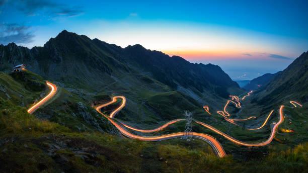
Overview: The Transfăgărășan Highway is often hailed as one of the most spectacular drives in the world, famously dubbed “the best road in the world” by Top Gear. Carved into the rugged Făgăraș Mountains, part of the Southern Carpathians, this Romanian road trip offers a thrilling combination of hairpin turns, alpine scenery, glacial lakes, and dramatic tunnels. Originally built as a military route during the Ceaușescu era in the 1970s, the road has since become a bucket-list destination for adventurers and driving enthusiasts.
Stretching across the heart of Romania, the Transfăgărășan provides more than just adrenaline. It weaves through myth-laden Transylvania, offering access to medieval castles, wildlife-rich forests, and some of the highest peaks in the country. Along the route, travelers can stop to explore iconic sites, including the majestic Balea Lake and the haunting ruins of Poenari Castle, linked to the legend of Dracula. It’s a short but unforgettable journey through Romania’s wildest landscapes.
Distance: The Transfăgărășan Highway stretches approximately 90 kilometers (56 miles) between the villages of Bascov (near Pitești) in the south and Cârțișoara in the north. Although short in distance, the drive is slow-going due to sharp curves, steep ascents, and frequent stops for sightseeing.
Route: The road begins near the city of Pitești and quickly ascends into the Făgăraș Mountains, winding its way past thick forests and plunging ravines. It crosses the dramatic Vidraru Dam and follows the edge of Lake Vidraru, a man-made reservoir nestled in steep, wooded valleys.
The southern ascent leads to the road’s crown jewel: Balea Lake, a glacial lake set in a high-altitude cirque at over 2,000 meters. A long tunnel—Balea Tunnel—connects the southern and northern sections beneath the crest of the mountains. From here, the descent toward Cârțișoara reveals a dizzying sequence of hairpin turns and sweeping views that have earned the road its legendary status.
Estimated Time to Complete: Driving the full Transfăgărășan typically takes 3 to 5 hours, depending on weather, road conditions, and sightseeing stops. Many travelers choose to make it a full-day excursion or include it as part of a multi-day road trip through Transylvania or Wallachia.
Things to See on the Way: Balea Lake is one of the most iconic stops, offering opportunities for hiking, photography, or even a stay at the seasonal Ice Hotel in winter. The Balea Waterfall, accessible via a short hike or cable car, is another natural highlight.
Vidraru Dam is an engineering marvel with dramatic views, while Poenari Fortress—perched on a narrow cliffside ridge—is steeped in history as one of Vlad the Impaler’s strongholds. Reaching the ruins requires a strenuous climb up nearly 1,500 steps, but the views and atmosphere are worth the effort.
Wildlife lovers might spot brown bears along the roadside (though feeding them is discouraged), and birdwatchers can catch glimpses of eagles and other raptors in the alpine heights.
Budget: Romania is one of Europe’s more affordable travel destinations. A day trip on the Transfăgărășan can be done for as little as 40 to 80 EUR, covering fuel, food, and basic entry fees. Renting a car for a day typically costs 30 to 60 EUR, while budget travelers using local buses or tours can explore the route for even less.
Staying overnight in guesthouses or mountain lodges around Balea Lake or Cârțișoara adds to the experience and can range from 25 to 100 EUR per night depending on comfort level. Meals are reasonably priced, with hearty Romanian dishes widely available along the route.
Difficulty: Driving the Transfăgărășan is moderately challenging. The road is paved and generally in good condition but features sharp curves, steep gradients, and occasional falling rocks. Summer traffic can include slow-moving vehicles and cyclists. Caution is required, especially in fog or wet conditions.
The highway is only open from late June to early November, depending on snowfall. In winter, the central section near Balea Lake is closed to vehicles, though it can be accessed by cable car for winter sports or scenic visits.
Need to Know: Check road conditions before departure, especially in early summer or late fall when snow can linger. Driving is on the right side in Romania, and an EU-standard license is accepted. Fuel up before starting, as there are limited gas stations along the route.
Dress in layers, as temperatures can drop quickly at high altitudes. Bring cash for small purchases and entrance fees, as not all rural establishments accept cards. Mobile signal can be patchy in the higher sections of the drive.
If hiking or climbing is part of your plan, weather can change rapidly in the mountains, so be prepared with proper gear and water.
Recommended Vehicle: A standard car with good brakes and steering is sufficient for the Transfăgărășan. Motorcycles are popular among thrill-seekers, but riders should be cautious of weather and road debris. Sports cars or convertibles are a favorite for scenic drives, but avoid low-clearance vehicles during or after rain.
For those not wishing to drive themselves, day tours with local guides are available from cities like Sibiu or Brașov.
Top Photo Spot: The northern approach to Balea Lake offers the most iconic view—an aerial-like perspective of the sinuous road zigzagging up the mountainside. Another stunning spot is from the Balea Tunnel exit looking down toward the valley, especially at sunrise or sunset when the light casts dramatic shadows across the peaks. The Vidraru Dam and the ruins of Poenari Castle also provide unforgettable photo opportunities with rich historical and natural context.
29.) Carretera Austral (Chile)

Overview: The Carretera Austral is one of South America’s most remote and scenic road trips, slicing through the heart of Chilean Patagonia. Also known as Route 7, this legendary road stretches across a land of dramatic contrasts—turquoise rivers, glacial valleys, dense temperate rainforests, snowcapped peaks, and fjords. Often described as Chile’s ultimate off-the-beaten-path journey, the Carretera Austral offers an immersive experience in raw wilderness, far removed from mass tourism.
Built during the Pinochet era to connect isolated Patagonian communities, the highway remains sparsely populated, with long stretches of gravel road threading through some of the world’s last truly wild frontiers. Adventurous travelers will find hidden thermal springs, towering glaciers, national parks teeming with wildlife, and deep cultural connections with the locals who live at the end of the world. It’s a road trip where nature dictates the pace, and the journey itself is the destination.
Distance: The Carretera Austral spans approximately 1,240 kilometers (770 miles), running from Puerto Montt in the north to Villa O’Higgins in the south. Though the distance can be driven in about two weeks, most travelers take longer to explore the surrounding landscapes and towns.
Route: Starting in Puerto Montt, the road leads south through the verdant Los Lagos Region, requiring ferry crossings over fjords and rivers. It passes through Chaitén and the Pumalín Douglas Tompkins National Park, one of the world’s largest private nature reserves, then continues to the alpine town of Futaleufú, a world-class white-water rafting hub.
Further south, the route skirts Lago General Carrera—Chile’s largest lake—with opportunities to visit the iconic Marble Caves. Travelers continue through the Aysén Region, entering the rugged terrain of Cerro Castillo and Patagonia National Park. The final stretch toward Villa O’Higgins becomes increasingly remote and wild, with few services and a true sense of isolation.
Estimated Time to Complete: Most travelers spend two to three weeks driving the full Carretera Austral, allowing time for ferry crossings, unpaved road conditions, detours to natural landmarks, and rest days. A shorter version focusing on the northern or central segments can be done in 7–10 days.
Things to See on the Way: Highlights include the ancient forests and fjords of Pumalín Park, the steaming hot springs near Puyuhuapi, and the hanging glacier of Queulat National Park. The Marble Caves on Lago General Carrera are a surreal sight—smooth, swirling rock formations accessible only by boat or kayak.
Cerro Castillo, a jagged mountain range reminiscent of Patagonia’s Torres del Paine, is a paradise for trekkers. Patagonia National Park, once private conservation land, offers vast open valleys, guanacos, and condors in a landscape of striking beauty. Further south, the remote village of Caleta Tortel, with its stilt houses and boardwalks, offers a unique cultural and architectural experience.
Budget: The Carretera Austral can suit a range of budgets, though costs are slightly higher due to its remoteness. Budget travelers using buses and camping or hostels can expect to spend about 30,000 to 50,000 CLP per day (~35 to 60 USD). Mid-range travelers renting a car and staying in guesthouses might spend around 75,000 to 120,000 CLP per day (~90 to 140 USD).
Fuel is expensive and limited, so refueling at every opportunity is essential. Entrance fees to national parks are generally affordable. Food costs vary depending on remoteness, with local markets and home-cooked meals being the most economical.
Difficulty: The Carretera Austral is moderately difficult. About half the road remains unpaved, especially in the southern stretches, and potholes, landslides, and weather delays are common. Road signage is minimal, and services can be sparse for hundreds of kilometers.
Navigation is straightforward, but conditions require patience, a cautious driving style, and some mechanical self-sufficiency. Ferry schedules can affect timing, and some sections may be closed after heavy rain or snow.
Need to Know: The road is best traveled between November and March, during the Patagonian summer. Rental cars should be booked in advance and ideally include high-clearance and full insurance coverage. Ferries must be reserved ahead, especially in peak season. Bringing cash is essential, as many small towns lack ATMs and may not accept cards.
Mobile reception is limited or nonexistent in much of the route, so offline maps are recommended. Fuel up whenever possible, and carry a spare tire, basic tools, food, and water for emergencies. Spanish is the primary language, so basic phrases or a translation app can be useful when navigating rural areas.
Recommended Vehicle: A 4WD or high-clearance SUV is strongly recommended due to gravel roads and unpredictable weather. Motorbikes and bicycles are also popular for adventure travelers, but require greater endurance and preparation. Campervans are a popular option for independent travelers wanting to combine transport and accommodation, though many roads remain narrow and rough.
Top Photo Spot: The Marble Caves on Lago General Carrera are among the most photogenic natural wonders on the route, especially when lit by the morning sun. Another breathtaking view is the road winding through the mountains near Cerro Castillo, with glacial peaks rising above golden Patagonian steppe. Sunrise over the Baker River, Chile’s most powerful waterway, offers another unforgettable visual moment of Patagonia’s raw majesty.
30.) Lofoten Islands Road Trip (Norway)

Overview: The Lofoten Islands offer one of the most enchanting and visually arresting road trips in all of Europe. Located above the Arctic Circle in northern Norway, this archipelago feels like a world unto itself—where jagged mountain peaks rise directly from the sea, colorful fishing villages dot the coastline, and the sky dances with the midnight sun or northern lights, depending on the season. A road trip through the Lofoten Islands captures the surreal blend of raw nature, Norse history, and Nordic culture, all stitched together by one of the most scenic routes on the planet.
Driving along the E10, the main road that links the islands from east to west, is an immersive experience. You’ll traverse narrow causeways and bridges connecting a string of islands, passing through fishing hamlets, Arctic beaches, and deep fjords. It’s a trip that rewards both slow travel and spontaneous detours, with countless opportunities for hiking, photography, kayaking, or just soaking in the serenity of the north.
Distance: The full stretch of the Lofoten road trip runs about 230 kilometers (143 miles) from the town of Svolvær in the northeast to the village of Å at the southwestern end of the archipelago. Although short in length, the route is packed with scenic stops and cultural highlights, making it ideal for a multi-day journey.
Route: Starting in Svolvær, the cultural hub of the islands, the E10 heads west through Kabelvåg and Henningsvær—charming fishing villages known for their rorbuer (red seaside cabins), art galleries, and seafood. The road winds past mountains and fjords, leading to the white-sand beach of Ramberg and the spectacular village of Reine, often considered the most beautiful spot in Lofoten.
The journey ends in the tiny village of Å, aptly named for being the last letter in the Norwegian alphabet—and the last stop on the road. Here, time seems to slow down among wooden houses, old fishing boats, and crashing Arctic waves. Along the way, detours to hiking trails, surfing spots like Unstad Beach, and hidden coves reveal the islands’ untamed beauty.
Estimated Time to Complete: While the drive could be completed in a single day, most travelers spend between four to six days exploring the islands at a relaxed pace. Longer stays are recommended if you’re planning on hiking, wildlife watching, or experiencing seasonal events like the northern lights or midnight sun.
Things to See on the Way: Svolvær offers a mix of modern galleries and WWII history, along with boat trips to Trollfjord. Henningsvær is a photogenic gem, perched on small islets and home to the world-famous Arctic football pitch. The beaches at Haukland, Uttakleiv, and Ramberg are shockingly tropical in appearance, with crystal-clear water and golden sand framed by icy peaks.
Reine is a highlight, with its picture-perfect harbor and access to Reinebringen, a steep hike with a world-class view. Nusfjord is one of Norway’s oldest and best-preserved fishing villages, offering a living museum experience. Bird watchers may visit Røst Island, while those seeking solitude can wander off to secluded fjords, trails, or remote cabins by the sea.
Budget: Traveling in the Lofoten Islands is relatively expensive due to Norway’s high cost of living. Budget travelers camping or staying in hostels can expect to spend around 700–1,000 NOK per day (~65–95 USD), while mid-range travelers using rental cars and staying in rorbuer or guesthouses may spend 1,500–2,500 NOK daily (~140–230 USD).
Food, fuel, and activities like kayaking or guided tours can quickly add up. To save money, consider cooking your own meals, traveling in the shoulder season (May or September), and booking accommodations well in advance.
Difficulty: The drive itself is easy and well-maintained, but the roads can be narrow and winding, especially in rural areas. Weather is the main challenge—conditions can change rapidly, with sudden fog, rain, or snow depending on the season. Summer offers endless daylight, while winter brings shorter days and icy roads that require extra caution.
Traffic is generally light, but cyclists and campervans are common in summer, and parking can be limited at popular viewpoints and trailheads.
Need to Know: Car rentals are available in Svolvær or at nearby airports (Harstad/Narvik or Leknes). The best time to visit is from June to September for hiking and fair weather, or from late September to March for northern lights viewing. Bring layers and waterproof gear regardless of season, as conditions can shift quickly.
Many attractions are free, including beaches and hikes, but some museums and guided tours require reservations. Gas stations and grocery stores are limited in remote areas, so plan ahead. Public transport exists but is limited; self-driving offers the most flexibility.
Recommended Vehicle: A compact car or SUV is sufficient for the Lofoten Islands, as the roads are paved and in good condition. During winter months, make sure your rental includes winter tires and chains. Campervans are a popular option and allow for flexible itineraries, though they may be harder to maneuver in narrow spots.
Top Photo Spot: Reinebringen offers the most iconic view in Lofoten, with its dramatic panorama over the fishing village of Reine, surrounded by fjords and mountains. Henningsvær’s football pitch from above is another viral shot, especially at sunset. For dramatic light and reflections, sunrise at Hamnøy is unbeatable—photographers often return multiple times to capture it in different conditions.
Happy Road Tripping ! — and good luck finding freedom on these incredible Road Trips !
